Bohle, Queensland
| Bohle Townsville, Queensland | |||||||||||||||
|---|---|---|---|---|---|---|---|---|---|---|---|---|---|---|---|
 Enterprise Street, Bohle | |||||||||||||||
 Bohle | |||||||||||||||
| Coordinates | 19°14′45″S 146°43′16″E / 19.2458°S 146.7210°E | ||||||||||||||
| Population | 121 (2021 census)[1] | ||||||||||||||
| • Density | 15.71/km2 (40.7/sq mi) | ||||||||||||||
| Postcode(s) | 4818 | ||||||||||||||
| Area | 7.7 km2 (3.0 sq mi) | ||||||||||||||
| Time zone | AEST (UTC+10:00) | ||||||||||||||
| Location |
| ||||||||||||||
| LGA(s) | City of Townsville | ||||||||||||||
| State electorate(s) | Townsville | ||||||||||||||
| Federal division(s) | Herbert | ||||||||||||||
| |||||||||||||||
Bohle is a northern suburb in the City of Townsville, Queensland, Australia.[2] In the 2021 census, Bohle had a population of 121 people.[1]
Geography
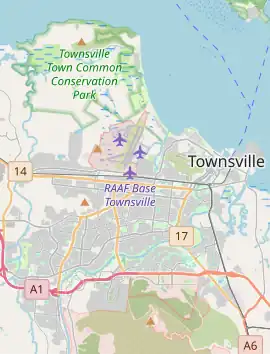
The southern half of the suburb is predominaly occupied by the Bohle Industrial Estate (19°15′28″S 146°42′50″E / 19.2578°S 146.7140°E).[3] There is a small residential area around Clay Street (19°15′46″S 146°42′56″E / 19.2628°S 146.71551°E) and a caravan park in Ingham Road (19°15′45″S 146°42′50″E / 19.2625°S 146.7138°E).[4]
The northern half of the suburb is a restricted area occupied by the Bohle Transmitter Station, an Australian Defence Force facility occupying 484 hectares (1,200 acres) with a transmission mast (19°14′16″S 146°43′20″E / 19.2378°S 146.7223°E) which forms part of the Modernised High Frequency Communications System.[5][4]
History
Bohle is situated in the traditional Wulgurukaba Aboriginal country.[6] The suburb takes its name from the Bohle River, which was named after Henry Mackinnon Bohle (1842–1923), a pioneer who brought cattle to the district in 1863.[7] On 1 September 1967 the district was first named by the Queensland Place Names Board, becoming a suburb on 12 June 1992.[2]
Bohlevale State School opened on 20 November 1911.[8] As at 2020, it is within the neighbouring suburb of Burdell.[4]
Demographics
In the 2016 census, Bohle had a population of 85 people.[9]
In the 2021 census, Bohle had a population of 121 people.[1]
Education
There are no schools in Bohle. The nearest government primary school is Bohlevale State School in neighbouring Burdell to the west. The nearest government secondary schools are Northern Beaches State High School in Deeragun to the west and Heatley Secondary College in Heatley to the south-east.[10]
References
- ^ a b c Australian Bureau of Statistics (28 June 2022). "Bohle (SAL)". 2021 Census QuickStats. Retrieved 28 February 2023.
- ^ a b "Bohle – suburb in City of Townsville (entry 44575)". Queensland Place Names. Queensland Government. Retrieved 17 May 2020.
- ^ "About Bohle Industrial Estate". Bohle IE. Economic Development Queensland. Archived from the original on 11 March 2020. Retrieved 17 June 2020.
- ^ a b c "Queensland Globe". State of Queensland. Retrieved 17 June 2020.
- ^ "Bohle Transmitter Station, Queensland" (PDF). Australian Defence Department. 1 October 2013. Archived (PDF) from the original on 21 May 2018. Retrieved 18 June 2020.
- ^ "Traditional Landowners - History and Heritage". Retrieved 25 June 2020.
- ^ "Henry Mackinnon Bohle". eHive. Australian Stockman's Hall of Fame. Archived from the original on 17 June 2020. Retrieved 17 June 2020.
- ^ Queensland Family History Society (2010), Queensland schools past and present (Version 1.01 ed.), Queensland Family History Society, ISBN 978-1-921171-26-0
- ^ Australian Bureau of Statistics (27 June 2017). "Bohle (SSC)". 2016 Census QuickStats. Retrieved 20 October 2018.
- ^ "Layers: Locality; Schools and school catchments". Queensland Globe. Queensland Government. Retrieved 28 July 2025.