Col de Latrape
| Col de Latrape | |
|---|---|
.jpg) | |
| Elevation | 1,111 m (3,645 ft)[1] |
| Traversed by | D8F |
| Location | Ariège, France |
| Range | Pyrenees |
| Coordinates | 42°47′44″N 1°18′51″E / 42.79556°N 1.31417°E |
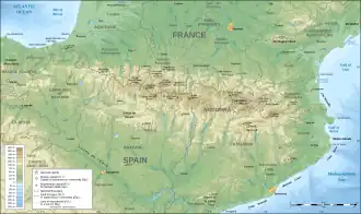 Location in the Pyrenees | |
The Col de Latrape (elevation 1,111 m (3,645 ft)) is a mountain pass in the French Pyrenees in the department of Ariège, between the communities of Aulus-les-Bains (east) and Ustou (west).
Details of climb
Starting from Aulus-les-Bains, the climb is 5.0 km (3.1 mi) long. Over this distance, the climb is 368 m (1,207 ft) (an average gradient of 7.4%), with the steepest sections being at 10.0%.[2]
Starting from Sérac d'Ustou, the climb is 5.9 km (3.7 mi) long. Over this distance, the climb is 423 m (1,388 ft) (an average gradient of 7.2%), with the steepest section being at 11%.[3]
Appearances in Tour de France
The Col de Latrape was first used in the Tour de France in 1956, since when it has featured eight times, most recently in 2017, when the leader over the summit was Alessandro De Marchi.[4]
| Year | Stage | Category | Start | Finish | Leader at the summit |
|---|---|---|---|---|---|
| 2017 | 13 | 1 | Saint-Girons | Foix | |
| 2011 | 14 | 2 | Saint-Gaudens | Plateau de Beille | |
| 2004 | 13 | 2 | Lannemezan | Plateau de Beille | |
| 2003 | 14 | 2 | Saint-Girons | Loudenvielle | |
| 1995 | 14 | 3 | Saint-Orens-de-Gameville | Guzet-Neige | |
| 1988 | 14 | 2 | Blagnac | Guzet-Neige | |
| 1984 | 11 | 2 | Pau | Guzet-Neige | |
| 1956 | 13 | 3 | Bagnères-de-Luchon | Toulouse |
References
- ^ IGN map
- ^ "Col de Latrape from Aulus les Bains : 1111m". Cols-cyclisme. Retrieved 2025-07-31.
- ^ "Col de Latrape from Sérac : 1111m". Cols-cyclisme. Retrieved 2025-07-31.
- ^ "Le Col de Latrape dans le Tour de France" (in French). Retrieved 4 August 2022.