Dolný Ohaj
Dolný Ohaj | |
|---|---|
 | |
 Flag | |
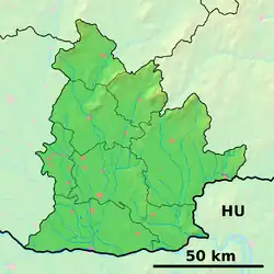 Dolný Ohaj Location of Dolný Ohaj in the Nitra Region 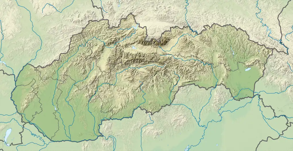 Dolný Ohaj Location of Dolný Ohaj in Slovakia | |
| Coordinates: 48°05′N 18°15′E / 48.08°N 18.25°E | |
| Country | |
| Region | |
| District | Nové Zámky District |
| First mentioned | 1293 |
| Area | |
• Total | 17.03 km2 (6.58 sq mi) |
| Elevation | 123 m (404 ft) |
| Population (2021)[3] | |
• Total | 1,487 |
| Time zone | UTC+1 (CET) |
| • Summer (DST) | UTC+2 (CEST) |
| Postal code | 941 43[2] |
| Area code | +421 35[2] |
| Car plate | NZ |
| Website | www |
Dolný Ohaj (Hungarian: Ohaj) is a municipality and village in the Nové Zámky District in the Nitra Region of south-west Slovakia.
History
In historical records the village was first mentioned in 1293.
Geography
The village lies at an altitude of 124 metres and covers an area of 17.928 km2. It has a population of about 1720 people.
Ethnicity
The population is about 98% Slovak.
Facilities
The village has a public library.
Genealogical resources
The records for genealogical research are available at the state archive "Statny Archiv in Nitra, Slovakia"
- Roman Catholic church records (births/marriages/deaths): 1787-1895 (parish A)
- Reformated church records (births/marriages/deaths): 1785-1951 (parish B)
See also
References
- ^ "Hustota obyvateľstva - obce [om7014rr_ukaz: Rozloha (Štvorcový meter)]". www.statistics.sk (in Slovak). Statistical Office of the Slovak Republic. 2022-03-31. Retrieved 2022-03-31.
- ^ a b c "Základná charakteristika". www.statistics.sk (in Slovak). Statistical Office of the Slovak Republic. 2015-04-17. Retrieved 2022-03-31.
- ^ "Počet obyvateľov podľa pohlavia - obce (ročne)". www.statistics.sk (in Slovak). Statistical Office of the Slovak Republic. 2022-03-31. Retrieved 2022-03-31.
External links