Gucheng County, Hubei
Gucheng County
谷城县 Kucheng | |
|---|---|
 Laohekou Binjiang Park (湖北老河口滨江公园) | |
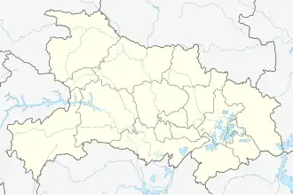 Gucheng Location of the seat in Hubei | |
| Coordinates (Gucheng government): 32°15′50″N 111°39′11″E / 32.264°N 111.653°E | |
| Country | People's Republic of China |
| Province | Hubei |
| Prefecture-level city | Xiangyang |
| Area | |
• Total | 2,553 km2 (986 sq mi) |
| Elevation | 86 m (283 ft) |
| Population (2020)[2] | |
• Total | 483,293 |
| • Density | 190/km2 (490/sq mi) |
| Time zone | UTC+8 (China Standard) |
| Website | hbgucheng |
Gucheng County (simplified Chinese: 谷城县; traditional Chinese: 穀城縣[3]; pinyin: Gǔchéng Xiàn) is a county of northwestern Hubei province, People's Republic of China, located in the eastern foothills of the Daba Mountains. It is under the administration of Xiangyang City, and is served by G70 Fuzhou–Yinchuan Expressway. As of 2004, it had a total population of 540,000 residing in an area of 2,552 square kilometres (985 sq mi).
Administrative divisions
- Chengguan (城关镇), Shihua (石花镇), Shengkang (盛𡐓镇[6]/盛康镇), Miaotan (庙滩镇), Wushan (五山镇), Cihe (茨河镇), Nanhe (南河镇), Zijin (紫金镇), Lengji (冷集镇)
The only township is Zhaowan Township (赵湾乡)
Other areas:
Climate
| Climate data for Gucheng, elevation 120 m (390 ft), (1991–2020 normals, extremes 1981–present) | |||||||||||||
|---|---|---|---|---|---|---|---|---|---|---|---|---|---|
| Month | Jan | Feb | Mar | Apr | May | Jun | Jul | Aug | Sep | Oct | Nov | Dec | Year |
| Record high °C (°F) | 22.3 (72.1) |
25.5 (77.9) |
30.1 (86.2) |
35.0 (95.0) |
37.2 (99.0) |
40.6 (105.1) |
42.1 (107.8) |
41.7 (107.1) |
38.7 (101.7) |
33.8 (92.8) |
29.6 (85.3) |
23.5 (74.3) |
42.1 (107.8) |
| Mean daily maximum °C (°F) | 7.9 (46.2) |
11.2 (52.2) |
16.5 (61.7) |
23.1 (73.6) |
27.8 (82.0) |
31.1 (88.0) |
32.7 (90.9) |
31.9 (89.4) |
28.1 (82.6) |
23.0 (73.4) |
16.5 (61.7) |
10.2 (50.4) |
21.7 (71.0) |
| Daily mean °C (°F) | 3.2 (37.8) |
6.0 (42.8) |
10.9 (51.6) |
17.0 (62.6) |
22.0 (71.6) |
25.8 (78.4) |
27.8 (82.0) |
27.1 (80.8) |
22.8 (73.0) |
17.1 (62.8) |
10.7 (51.3) |
5.3 (41.5) |
16.3 (61.3) |
| Mean daily minimum °C (°F) | −0.2 (31.6) |
2.1 (35.8) |
6.5 (43.7) |
12.2 (54.0) |
17.2 (63.0) |
21.5 (70.7) |
24.2 (75.6) |
23.7 (74.7) |
18.9 (66.0) |
12.9 (55.2) |
6.5 (43.7) |
1.8 (35.2) |
12.3 (54.1) |
| Record low °C (°F) | −6.4 (20.5) |
−10.7 (12.7) |
−5.5 (22.1) |
−0.3 (31.5) |
5.7 (42.3) |
14.1 (57.4) |
17.2 (63.0) |
15.2 (59.4) |
10.5 (50.9) |
1.6 (34.9) |
−3.2 (26.2) |
−13.7 (7.3) |
−13.7 (7.3) |
| Average precipitation mm (inches) | 26.8 (1.06) |
26.9 (1.06) |
54.9 (2.16) |
69.4 (2.73) |
103.8 (4.09) |
104.3 (4.11) |
121.7 (4.79) |
129.7 (5.11) |
59.9 (2.36) |
66.6 (2.62) |
43.5 (1.71) |
19.3 (0.76) |
826.8 (32.56) |
| Average precipitation days (≥ 0.1 mm) | 6.4 | 7.5 | 9.1 | 9.5 | 11.3 | 10.5 | 11.6 | 12.2 | 11.3 | 10.1 | 8.4 | 6.0 | 113.9 |
| Average snowy days | 4.1 | 3.2 | 1.1 | 0 | 0 | 0 | 0 | 0 | 0 | 0 | 0.7 | 2.0 | 11.1 |
| Average relative humidity (%) | 73 | 72 | 71 | 71 | 71 | 75 | 80 | 81 | 77 | 74 | 74 | 72 | 74 |
| Mean monthly sunshine hours | 97.8 | 105.5 | 137.0 | 163.0 | 176.5 | 164.2 | 172.2 | 168.9 | 134.4 | 132.5 | 117.9 | 108.6 | 1,678.5 |
| Percentage possible sunshine | 31 | 33 | 37 | 42 | 41 | 39 | 40 | 41 | 37 | 38 | 38 | 35 | 38 |
| Source: China Meteorological Administration[7][8]all-time extreme temperature[9][10] | |||||||||||||
References
- ^ a b 谷城县历史沿革 [Gucheng County Historical Development] (in Simplified Chinese). XZQH.org. 6 August 2014. Retrieved 6 September 2018.
1996年,谷城县面积2553平方千米,{...}2010年第六次人口普查,谷城县常住总人口其中:523607人,城关镇178990人,石花镇108753人,盛土康镇56582人,庙滩镇42184人,五山镇26932人,茨河镇16550人,南河镇17447人,紫金镇17527人,冷集镇47288人,赵湾乡9567人,薤山林场1787人。
- ^ "China: Húbĕi (Prefectures, Cities, Districts and Counties) - Population Statistics, Charts and Map". www.citypopulation.de. Retrieved 2024-11-22.
- ^ https://archive.org/details/mapofchinashan/page/34 "Kucheng Hup 穀城 Hupeh ... 湖北 ... 32.16N 111.46E"
- ^ 行政区划 [Administrative Divisions]. 谷城县人民政府 (in Simplified Chinese). 中共谷城县委, 谷城县人民政府, 谷城县广播电视台网络新闻中心. 27 December 2017. Retrieved 6 September 2018.
2016年,谷城县辖城关、冷集、石花、五山、紫金、南河、盛康、庙滩、茨河9个镇和赵湾乡,设谷城经济开发区和薤山旅游度假区,242个行政村、48个社区居民委员会。
- ^ 2017年统计用区划代码和城乡划分代码:谷城县 [2017 Statistical Area Numbers and Rural-Urban Area Numbers: Gucheng County]. National Bureau of Statistics of the People's Republic of China. 2017. Retrieved 6 September 2018.
统计用区划代码 名称 420625100000 城关镇 420625101000 石花镇 420625102000 盛康镇 420625103000 庙滩镇 420625104000 五山镇 420625105000 茨河镇 420625106000 南河镇 420625107000 紫金镇 420625108000 冷集镇 420625200000 赵湾乡 420625500000 薤山林场
- ^ Chinese Academy of Social Sciences, ed. (1 September 2016). 现代汉语词典 [A Dictionary of Current Chinese] (in Chinese) (Seventh ed.). Beijing: The Commercial Press. p. 731. ISBN 978-7-100-12450-8.
𡐓 kāng 盛𡐓镇(Shèngkāng Zhèn),地名,在湖北。
- ^ 中国气象数据网 – WeatherBk Data (in Simplified Chinese). China Meteorological Administration. Retrieved 11 June 2023.
- ^ "Experience Template" 中国气象数据网 (in Simplified Chinese). China Meteorological Administration. Retrieved 28 May 2023.
- ^ "Extreme Temperatures Around the World". Retrieved 17 July 2025.
- ^ "Sina Visitor System" 【疯狂的高温】今天有1076个国家气象站出现35℃以上高温,占比44.8%。今天有102个站点达到40℃以上。酷热站数之多,同期少见。湖北陕西山西河南四川重庆甘肃,共有46站气温打破7月最高纪录,其中19站打破观测史最高纪录。陕西的兴平和勉县连续2天打破观测史最高纪录,陕西汉中、湖北巴东连续2天打破7月最高气温纪录,今天破观测史纪录。另外,较高海拔的四川九寨沟37.8℃、湖北神农架38℃,也打破了观测史最高纪录(如果神农架有野人,估计也热中暑了)。今天有14个省会首府直辖市出现高温,重庆沙坪坝41.3℃、成都温江38.3℃、兰州36.8℃创出今年气温新高,成都温江也打破当地7月最高气温纪录。明天成都可能冲击40℃,长沙39℃,贵阳33℃,均可能创今年气温新高。而且青海四川重庆部分地区存在破纪录可能。总体来看,明天开始,陕西山西河南湖北安徽江苏浙江等地的高温开始减弱。但西部地区高温依然较强。今晚中央气象台继续发布高温橙色预警,重庆西部和北部、四川盆地中南部、内蒙古西北部、新疆吐鲁番盆地等地的部分地区可达40℃以上。18-19日中东部地区的高温强度不是很强,基本看不到40℃以上的酷热,但是范围依然不小。另外在新疆,因为高空暖脊的发展加强,高温也会更上一层楼。乌鲁木齐报出18-19日最高37-38℃,将创今年新高。 (in Simplified Chinese). weatherman_信欣 on Weibo. Retrieved 17 July 2025.
External links