Jagal, Pakistan
Jagal
جاگل | |
|---|---|
Village | |
 Jagal Location in Punjab, Pakistan | |
| Coordinates: 32°49′45″N 74°08′04″E / 32.82917°N 74.13444°E | |
| Country | |
| Province | Punjab |
| Region/Division | Gujrat |
| District | Gujrat |
| Tehsil | Kharian |
| Union Council | Dilawar-Pur |
| Time zone | UTC+5 (PST) |
| Postal Code | 50991 |
| Area code | 053 |
Jagal (Urdu: جاگل) is a village in Gujrat District, in the Punjab province of Pakistan.[1] The village is situated about 6 kilometres (4 mi) east of Kotla Arab Ali Khan. The village is 38 kilometres (24 mi) from Gujrat city and about 30 kilometres (19 mi) from Kharian city. Jagal is part of a union council named after the nearby village Dilawarpur, which is 2 kilometres (1 mi) to the east. The border of Azad Kashmir lies approximately 10 kilometres (6.2 mi) north of the village. The word Jagal comes from subcast of Gujjar. They are the people who started to live here more or less in the 15th century
Picture gallery
-
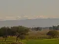 view from Jagal
 -
 hills View
 -
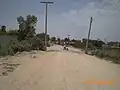 Road under construction
 -
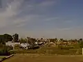 Jagal view
References
- ^ "Pakistan- Settlement | Humanitarian Dataset | HDX". data.humdata.org. dbf file in zip file. Retrieved 13 May 2025.
Wikimedia Commons has media related to Jagal (village).