Kinta River
| Kinta River | |
|---|---|
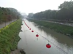 Kinta River, Ipoh | |
| Native name | Sungai Kinta (Malay) |
| Location | |
| Country | Malaysia |
| State | Perak |
| Physical characteristics | |
| Source | Titiwangsa Mountains |
| • location | Ulu Kinta, Kinta District |
| Mouth | Perak River |
• location | near Teluk Intan, Hilir Perak District |
| Length | 100 km (62 mi) |
| Basin size | 2,540 km2 (980 sq mi)[1] |
| Basin features | |
| Progression | Perak > Strait of Malacca |
Kinta River (Malay: Sungai Kinta) is a river in Perak, Malaysia. It gets its name from the Kinta Valley, which surrounds Ipoh, the capital of Perak. Ipoh sits along this river. There are many limestone hills in the area surrounding the river, and there used to be many tin mines. The supposedly largest tin field in the world was discovered in 1876 in the Kinta Valley.[2] The river was also well known for its wide variety of freshwater fish. The fisheries department reported a greater abundance of fish from the Intake Dam to Tasek, and from a secluded fish pool, 0.75 miles (1.21 km) down from Tanjung Rambutan. Fishing in this area used to be a major local activity until the fisheries gradually closed down.[3]
Kinta River is one of the main branches of the Perak River.
Major settlements
Major settlements along the river are:
See also
References
- ^ [1] Revised equations for Manning’s coefficient for sand-bed rivers. URL assessed on 6 October 2012
- ^ [2] Archived 7 April 2014 at the Wayback Machine Tin chapter, Page 112. URL assessed on 6 October 2012
- ^ Khoo Salma Nasution and Adbur-Razzaq Lubis, 2005. Kinta Valley: Pioneering Malaysia's Modern Development. Ipoh: Perak Academy. ISBN 983-42113-09
4°05′40″N 101°00′45″E / 4.09444°N 101.01250°E