Makaraka, New Zealand
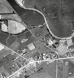
Makaraka is an outer suburb of Gisborne, in New Zealand's North Island, located in the west of the city.[3] The suburb features Gisborne's horse-racing circuit, Makaraka Racecourse.[4] It is part of the statistical area of Makaraka-Awapuni, which is covered at Awapuni.
Makaraka was settled by dairy farmers in the 19th century. A dairy factory was built in the settlement in 1899.[5]
The Tarere Marae, located near Makaraka, is a tribal meeting place of Te Whānau a Iwi, a hapū of Te Aitanga ā Māhaki.[6] It includes Te Aotipu meeting house.[7]
Demographics
Makaraka covers 3.26 km2 (1.26 sq mi).[1] It is part of the Makaraka-Awapuni statistical area.[8]
| Year | Pop. | ±% p.a. |
|---|---|---|
| 2006 | 399 | — |
| 2013 | 384 | −0.55% |
| 2018 | 444 | +2.95% |
| 2023 | 537 | +3.88% |
| Source: [2][9] | ||
Makaraka had a population of 537 in the 2023 New Zealand census, an increase of 93 people (20.9%) since the 2018 census, and an increase of 153 people (39.8%) since the 2013 census. There were 288 males, 246 females, and 3 people of other genders in 159 dwellings.[10] 2.2% of people identified as LGBTIQ+. There were 111 people (20.7%) aged under 15 years, 87 (16.2%) aged 15 to 29, 246 (45.8%) aged 30 to 64, and 90 (16.8%) aged 65 or older.[2]
People could identify as more than one ethnicity. The results were 66.5% European (Pākehā); 48.6% Māori; 7.3% Pasifika; 2.2% Asian; 0.6% Middle Eastern, Latin American and African New Zealanders (MELAA); and 3.4% other, which includes people giving their ethnicity as "New Zealander". English was spoken by 97.2%, Māori by 13.4%, Samoan by 3.9%, and other languages by 2.8%. No language could be spoken by 1.1% (e.g. too young to talk). The percentage of people born overseas was 11.2, compared with 28.8% nationally.[2]
Religious affiliations were 33.0% Christian, 0.6% Hindu, 3.9% Māori religious beliefs, 0.6% Buddhist, and 0.6% New Age. People who answered that they had no religion were 52.5%, and 10.1% of people did not answer the census question.[2]
Of those at least 15 years old, 48 (11.3%) people had a bachelor's or higher degree, 252 (59.2%) had a post-high school certificate or diploma, and 129 (30.3%) people exclusively held high school qualifications. 24 people (5.6%) earned over $100,000 compared to 12.1% nationally. The employment status of those at least 15 was 213 (50.0%) full-time, 75 (17.6%) part-time, and 12 (2.8%) unemployed.[2]
Education
Makaraka School is a Year 1–6 co-educational public primary school[11] with a roll of 109 as of July 2025.[12][13][14] It opened in 1875.[15]
Railway station
From 1902 to 1959 Mākaraka had a railway station on the Moutohora Branch and, from 1915 to 1931, was the junction for the Ngātapa Branch. It is now the mothballed Makaraka Industrial Line[16] and also has the East Coast Museum of Technology station building (from Matawhero) and museum on the former station site.[17]
| Disused railways | ||||
|---|---|---|---|---|
| Pātūtahi (Ngātapa Branch) Line and station closed 7.9 km (4.9 mi) |
Moutohora Branch | Park Racecourse Line mothballed, station closed 1.59 km (0.99 mi) | ||
| King's Road Line and station closed 3.14 km (1.95 mi) |
||||
References
- ^ a b "Stats NZ Geographic Data Service". Statistical Area 1 2023 (generalised). Retrieved 14 August 2025.
- ^ a b c d e f "Totals by topic for individuals, (RC, TALB, UR, SA3, SA2, Ward, Health), 2013, 2018, and 2023 Censuses". Stats NZ – Tatauranga Aotearoa – Aotearoa Data Explorer. 7015543, 7015544 and 7015545. Retrieved 3 October 2024.
- ^ Hariss, Gavin. "Makaraka, Gisborne". topomap.co.nz. NZ Topo Map.
- ^ "History of Gisborne Races". gisborneraces.co.nz. Poverty Bay Turf Club. Archived from the original on 13 January 2020. Retrieved 18 May 2019.
- ^ "The Cyclopedia of New Zealand [Auckland Provincial District] -- Makaraka". Christchurch: Cyclopedia Company Limited. 1902.
- ^ "Te Kāhui Māngai directory". tkm.govt.nz. Te Puni Kōkiri.
- ^ "Māori Maps". maorimaps.com. Te Potiki National Trust.
- ^ "Geographic Boundary Viewer". Stats NZ. Statistical Area 1 – 2023 and Statistical Area 2 – 2023.
- ^ "Statistical area 1 dataset for 2018 Census". Statistics New Zealand. March 2020. 7015543, 7015544 and 7015545.
- ^ "Totals by topic for dwellings, (RC, TALB, UR, SA3, SA2, Ward, Health), 2013, 2018, and 2023 Censuses". Stats NZ – Tatauranga Aotearoa – Aotearoa Data Explorer. Retrieved 3 October 2024.
- ^ "Official School Website". makaraka.school.nz.
- ^ "New Zealand Schools Directory". New Zealand Ministry of Education. Retrieved 1 July 2025.
- ^ "Ministry of Education School Profile". educationcounts.govt.nz. Ministry of Education.
- ^ "Education Review Office Report". ero.govt.nz. Education Review Office. Retrieved 14 August 2025.
- ^ "Makaraka School's community support". Sunrise Foundation. 1 November 2019.
- ^ "KiwiRail Network Map". kiwirail.maps.arcgis.com. November 2018. Retrieved 27 March 2023.
- ^ "Collections & Stories". E.C.M.o.T. 7 September 2016. Retrieved 27 March 2023.
- ^ Yonge, John Roger (1993). New Zealand Railway and Tramway Atlas. Quail Map Company. ISBN 9780900609923.