Oberland am Rennsteig
Oberland am Rennsteig | |
|---|---|
Location of Oberland am Rennsteig | |
 Oberland am Rennsteig 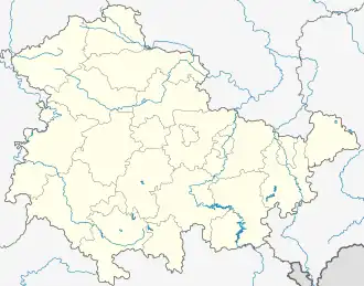 Oberland am Rennsteig | |
| Coordinates: 50°27′N 11°12′E / 50.450°N 11.200°E | |
| Country | Germany |
| State | Thuringia |
| District | Sonneberg |
| Disbanded | 2013 |
| Area | |
• Total | 39.27 km2 (15.16 sq mi) |
| Elevation | 580 m (1,900 ft) |
| Population (2012-12-31) | |
• Total | 2,200 |
| • Density | 56/km2 (150/sq mi) |
| Time zone | UTC+01:00 (CET) |
| • Summer (DST) | UTC+02:00 (CEST) |
| Postal codes | 96523, 96515 |
| Dialling codes | 03675, 036762 |
| Vehicle registration | SON |
Oberland am Rennsteig (German pronunciation: [ˈoːbɐlant ʔam ˈʁɛnʃtaɪk], lit. 'Highlands on the Rennsteig') is a former municipality in the Sonneberg district of Thuringia, Germany. Since 31 December 2013, it is part of the town Sonneberg.[1]
References