Ponniammanmedu
Ponniammanmedu | |
|---|---|
Neighbourhood | |
 Ponniammanmedu 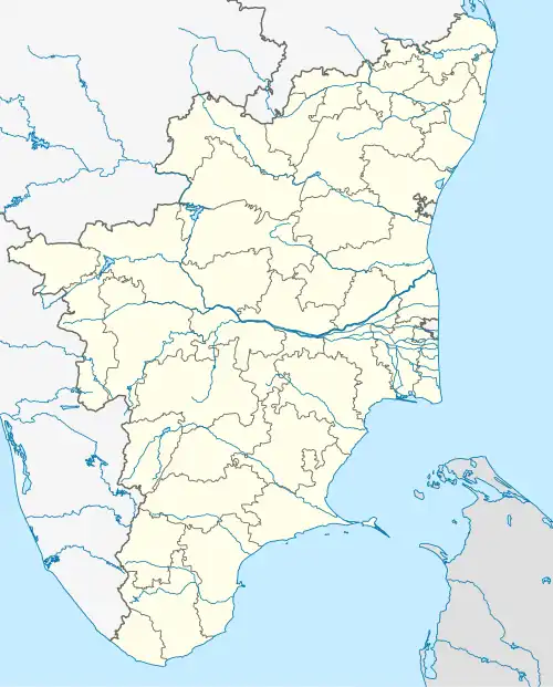 Ponniammanmedu  Ponniammanmedu | |
| Coordinates: 13°07′48″N 80°14′05″E / 13.129886°N 80.234778°E | |
| Country | |
| State | |
| District | Chennai district |
| Metro | Chennai |
| Zone | Madhavaram Zone No 3 |
| Elevation | 7 m (23 ft) |
| Languages | |
| • Official | Tamil |
| Time zone | UTC+5:30 (IST) |
| PIN | 600110 |
| Telephone code | 044 |
| Vehicle registration | TN-05-xx-xxxx |
| Planning agency | CMDA |
| City | Chennai |
| Lok Sabha constituency | North Chennai |
| Vidhan Sabha constituency | Madhavaram |
| Civic agency | Chennai Corporation |
Ponniammanmedu is a developing residential area and mid-segment locatlity in North Chennai, a metropolitan city in Tamil Nadu, India.[1] Ponniammanmedu is governed under the Tiruvallur district.[2]
Facilities
Schools
Ponniammanmedu has several educational facilities located within and near itself. These include the CSI Middle School, Matriculation Higher Secondary School, and Singaram Pillai Girls High School, among others.[3]
Hospitals
The locality of Ponniammanmedu has multiple nursing homes, clinics, and hospitals nearby.[3]
Shopping
Ponniammanmedu has several shopping complexes located around the area. These include the Lily Pond, Alsa Mall, and Cisons Shopping Complexes, and Chintadripet Market.[3]
Sub-Neighbourhoods
Ponniammanmedu has multiple small localities located within itself. These sub-localities include:
- Kodungaiyur
- Balaji Nagar
- Kumaran Nagar
- Peravallur
- Kolathur
- Moolakadai
- Madhavaram
- Retteri junction
- Thiruppathi Nagar
- Vajravel Nagar
- Balakumaran Nagar
Religion
Temples
Ponniammanmedu has numerous temples. These include the Somanatheswar, Lakshmi Amman, and Sri Shenbaga Vinayagar Temples.[3]
Churches
CSI Church and Perambu Lourdes Church are some of the important churches here.
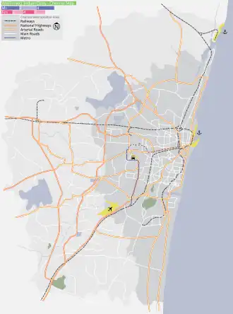
Transportation
Buses
Ponniammanmedu is easily accessible from the Moolakadai and Madhavaram bus terminals. Two frequent-service minibus shuttles also travel via Ponniammanmedu - the S61 Madhavaram to Perambur service, and the S68 Moolakadai to Agaram service. Ponniammanmedu is also served by the MTC public bus service.[3]
Rail
There are several nearby rail stations, including the Perambur Locomotive Works, Perambur, Vyasarpadi Jeeva, and Perambur Carriage Works Railway Stations.[3]
Aviation
The closest airport to the Ponniammanmedu neighbourhood is Chennai International Airport, which serves both domestic and international destinations.
Surroundings
Directions From Ponniammanmedu | ||||||||||||||||
|---|---|---|---|---|---|---|---|---|---|---|---|---|---|---|---|---|
| ||||||||||||||||
References
- ^ S. Muthiah (2008). Madras, Chennai: A 400-year Record of the First City of Modern India. Palaniappa Brothers. ISBN 978-81-8379-468-8.
- ^ "Ponniammanmedu Pin Code - 600110, All Post Office Areas PIN Codes, Search tiruvallur Post Office Address". news.abplive.com. Retrieved 29 October 2024.
- ^ a b c d e f "Ponniammanmedu, Chennai". Retrieved 15 July 2025.
| District headquarters | 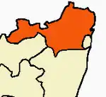 | |
|---|---|---|
| Country | ||
| State | ||
| Region | ||
| Revenue divisions | ||
| Taluks | ||
| Revenue blocks | ||
| Municipal corporations | ||
| Municipalities | ||
| Special grade town panchayats | ||
| Town panchayats | ||
| History | ||
| Places of interest |
| |
| Universities |
| |