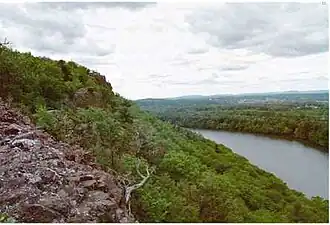
The Metacomet Ridge, Metacomet Ridge Mountains, or Metacomet Range of southern New England, United States, is a narrow and steep fault-block mountain ridge known for its extensive cliff faces, scenic vistas, microclimate ecosystems, and communities of plants considered rare or endangered. An important recreation resource located within 10 miles (16 km) of a population corridor of over 2.5 million people, the ridge is home to four long distance hiking trails and over a dozen parks and recreation areas including several state and nationally recognized historic sites. Because of its natural, historic, and recreational value, the ridge has been the focus of ongoing conservation efforts involving municipal, state, and national agencies as well as nearly two dozen non-profit organizations. The Metacomet Ridge extends from New Haven and Branford, Connecticut on Long Island Sound, through the Connecticut River Valley region of Massachusetts, to northern Franklin County, 2 miles (3.2 km), short of the Vermont and New Hampshire borders, a distance of 100 miles (160 km). (Full article...)
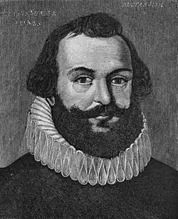
This portrait, first published in 1885, was alleged to be a 1625 likeness of Standish, although its authenticity has never been proven
Myles Standish was an English military officer hired by the Pilgrims as military advisor for Plymouth Colony. One of the Mayflower passengers, Standish played a leading role in the administration and defense of Plymouth Colony from its inception. On February 17, 1621, the Plymouth Colony militia elected him as its first commander and continued to re-elect him to that position for the remainder of his life. Standish served as an agent of Plymouth Colony in England, as assistant governor, and as treasurer of Plymouth Colony. He was also one of the first settlers and founders of the town of Duxbury, Massachusetts. (Full article...)
Selected picture
John F. Kennedy Presidential Library, on the campus of the University of Massachusetts Boston
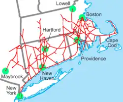
Image 2The MBTA Commuter Rail serves eastern Massachusetts and parts of Rhode Island, radiating from downtown Boston, with planned service to New Hampshire. The CTrail system operates the Shore Line East and Hartford Line, covering coastal Connecticut, Hartford, and Springfield, Massachusetts. (from New England)
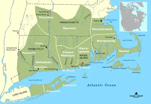
Image 29A political and geographical map of New England shows the coastal plains in the southeast, and hills, mountains and valleys in the west and the north. (from New England)
Image 47Largest self-reported ancestry groups in New England. Americans of Irish descent form a plurality in most of Massachusetts, while Americans of English descent form a plurality in much of the central parts of Vermont and New Hampshire as well as nearly all of Maine. (from New England)
... that Cora Agnes Benneson, one of the first female lawyers in New England, was rejected by Harvard Law School because "the equipments were too limited to make suitable provision for receiving women"?
... that the First Congregational Church of Litchfield, now regarded as iconic, was replaced in 1873 after being said to have "not a single line or feature ... suggesting taste or beauty"?
... that Nathaniel Ames, publisher of the first annual American almanac, avoided arrest by replacing his vituperative cartoon of local judges with a biblical quotation?
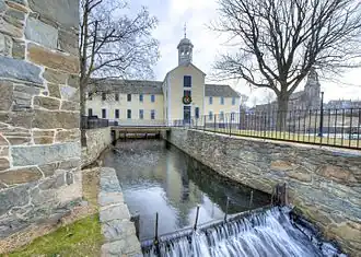
Rhode Island was the first of the original Thirteen Colonies to declare independence from British rule, declaring itself independent on May 4, 1776, two months before any other colony. The State was also the last of the thirteen original colonies to ratify the United States Constitution.
Rhode Island's official nickname is "The Ocean State," a reference to the State's geography, since Rhode Island has several large bays and inlets that amount to about fourteen (14) percent of its total area. Its land area is 1,045 square miles (2706 km2), but its total area is significantly larger. (Full article...)


.svg.png)


.jpg)
_(13202190293).jpg)