Portal:World
The World Portal

The world is the totality of entities, the whole of reality, or everything that exists. The nature of the world has been conceptualized differently in different fields. Some conceptions see the world as unique, while others talk of a "plurality of worlds". Some treat the world as one simple object, while others analyze the world as a complex made up of parts.
In scientific cosmology, the world or universe is commonly defined as "the totality of all space and time; all that is, has been, and will be". Theories of modality talk of possible worlds as complete and consistent ways how things could have been. Phenomenology, starting from the horizon of co-given objects present in the periphery of every experience, defines the world as the biggest horizon, or the "horizon of all horizons". In philosophy of mind, the world is contrasted with the mind as that which is represented by the mind.
Theology conceptualizes the world in relation to God, for example, as God's creation, as identical to God, or as the two being interdependent. In religions, there is a tendency to downgrade the material or sensory world in favor of a spiritual world to be sought through religious practice. A comprehensive representation of the world and our place in it, as is found in religions, is known as a worldview. Cosmogony is the field that studies the origin or creation of the world, while eschatology refers to the science or doctrine of the last things or of the end of the world.
In various contexts, the term "world" takes a more restricted meaning associated, for example, with the Earth and all life on it, with humanity as a whole, or with an international or intercontinental scope. In this sense, world history refers to the history of humanity as a whole, and world politics is the discipline of political science studying issues that transcend nations and continents. Other examples include terms such as "world religion", "world language", "world government", "world war", "world population", "world economy", or "world championship". (Full article...)
Selected articles -
-

The International Development Association (IDA) (French: Association internationale de développement) is a development finance institution which offers concessional loans and grants to the world's poorest developing countries. The IDA is a member of the World Bank Group and is headquartered in Washington, D.C. in the United States. It was established in 1960 to complement the existing International Bank for Reconstruction and Development by lending to developing countries which suffer from the lowest gross national income, from troubled creditworthiness, or from the lowest per capita income. Together, the International Development Association and International Bank for Reconstruction and Development are collectively generally known as the World Bank, as they follow the same executive leadership and operate with the same staff.
The association shares the World Bank's mission of reducing poverty and aims to provide affordable development financing to countries whose credit risk is so prohibitive that they cannot afford to borrow commercially or from the Bank's other programs. The IDA's stated aim is to assist the poorest nations in growing more quickly, equitably, and sustainably to reduce poverty. The IDA is the single largest provider of funds to economic and human development projects in the world's poorest nations. From 2000 to 2010, it financed projects which recruited and trained 3 million teachers, immunized 310 million children, funded $792 million in loans to 120,000 small and medium enterprises, built or restored 118,000 kilometers of paved roads, built or restored 1,600 bridges, and expanded access to improved water to 113 million people and improved sanitation facilities to 5.8 million people. The IDA has issued a total US$238 billion in loans and grants since its launch in 1960. Thirty-six of the association's borrowing countries have graduated from their eligibility for its concessional lending. However, nine of these countries have relapsed and have not re-graduated. (Full article...) -
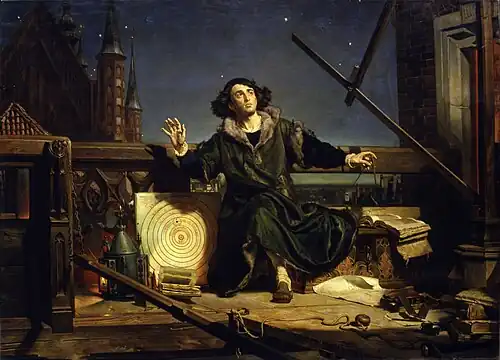
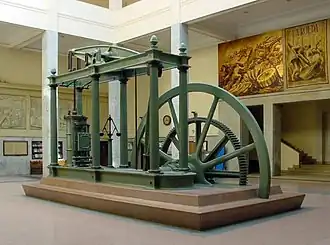
The Scientific Revolution was a series of events that marked the emergence of modern science during the early modern period, when developments in mathematics, physics, astronomy, biology (including human anatomy) and chemistry transformed the views of society about nature. The Scientific Revolution took place in Europe in the second half of the Renaissance period, with the 1543 Nicolaus Copernicus publication De revolutionibus orbium coelestium (On the Revolutions of the Heavenly Spheres) often cited as its beginning. The Scientific Revolution has been called "the most important transformation in human history" since the Neolithic Revolution.
The era of the Scientific Renaissance focused to some degree on recovering the knowledge of the ancients and is considered to have culminated in Isaac Newton's 1687 publication Principia which formulated the laws of motion and universal gravitation, thereby completing the synthesis of a new cosmology. The subsequent Age of Enlightenment saw the concept of a scientific revolution emerge in the 18th-century work of Jean Sylvain Bailly, who described a two-stage process of sweeping away the old and establishing the new. There continues to be scholarly engagement regarding the boundaries of the Scientific Revolution and its chronology. (Full article...) -
The Special Report on Global Warming of 1.5 °C (SR15) was published by the Intergovernmental Panel on Climate Change (IPCC) on 8 October 2018. The report, approved in Incheon, South Korea, includes over 6,000 scientific references, and was prepared by 91 authors from 40 countries. In December 2015, the 2015 United Nations Climate Change Conference called for the report. The report was delivered at the United Nations' 48th session of the IPCC to "deliver the authoritative, scientific guide for governments" to deal with climate change. Its key finding is that meeting a 1.5 °C (2.7 °F) target is possible but would require "deep emissions reductions" and "rapid, far-reaching and unprecedented changes in all aspects of society". Furthermore, the report finds that "limiting global warming to 1.5 °C compared with 2 °C would reduce challenging impacts on ecosystems, human health and well-being" and that a 2 °C temperature increase would exacerbate extreme weather, rising sea levels and diminishing Arctic sea ice, coral bleaching, and loss of ecosystems, among other impacts.
SR15 also has modelling that shows that, for global warming to be limited to 1.5 °C, "Global net human-caused emissions of carbon dioxide (CO2) would need to fall by about 45 percent from 2010 levels by 2030, reaching 'net zero' around 2050." The reduction of emissions by 2030 and its associated changes and challenges, including rapid decarbonisation, was a key focus on much of the reporting which was repeated through the world. (Full article...) -

The modern Olympic Games (Olympics; French: Jeux olympiques) are the world's preeminent international sporting events. They feature summer and winter sports competitions in which thousands of athletes from around the world participate in a variety of competitions. The Olympic Games, open to both amateur and professional athletes, involves more than 200 teams, each team representing a sovereign state or territory. By default, the Games generally substitute for any world championships during the year in which they take place (however, each class usually maintains its own records). The Olympics are staged every four years. Since 1994, they have alternated between the Summer and Winter Olympics every two years during the four-year Olympiad.
Their creation was inspired by the ancient Olympic Games, held in Olympia, Greece, from the 8th century BC to the 4th century AD. Baron Pierre de Coubertin founded the International Olympic Committee (IOC) in 1894, leading to the first modern Games in Athens in 1896. The IOC is the governing body of the Olympic Movement, which encompasses all entities and individuals involved in the Olympic Games. The Olympic Charter defines their structure and authority. (Full article...) -
International trade is the exchange of capital, goods, and services across international borders or territories because there is a need or want of goods or services. (See: World economy.)
In most countries, such trade represents a significant share of gross domestic product (GDP). While international trade has existed throughout history (for example Uttarapatha, Silk Road, Amber Road, salt roads), its economic, social, and political importance has been on the rise in recent centuries. (Full article...) -
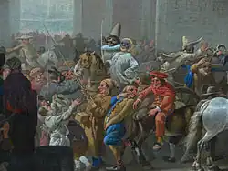
Around the World in 80 Treasures is a 10-episode art and travel documentary series by the BBC, presented by Dan Cruickshank, and originally aired in February, March, and April 2005. The title is a reference to Around the World in Eighty Days, the classic adventure novel by Jules Verne.
In this series, Cruickshank takes a five-month world tour visiting his choices of the eighty greatest man-made treasures, including buildings and artifacts. His tour takes him through 34 countries and 6 of the 7 continents (he does not visit Antarctica). He did not visit Iraq due to the dangerous state of the country at the time. (Full article...) -

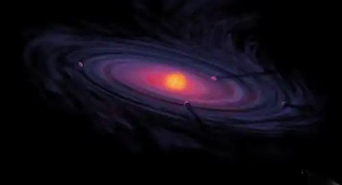
Artist's conception of a protoplanetary disk
There is evidence that the formation of the Solar System began about 4.6 billion years ago with the gravitational collapse of a small part of a giant molecular cloud. Most of the collapsing mass collected in the center, forming the Sun, while the rest flattened into a protoplanetary disk out of which the planets, moons, asteroids, and other small Solar System bodies formed.
This model, known as the nebular hypothesis, was first developed in the 18th century by Emanuel Swedenborg, Immanuel Kant, and Pierre-Simon Laplace. Its subsequent development has interwoven a variety of scientific disciplines including astronomy, chemistry, geology, physics, and planetary science. Since the dawn of the Space Age in the 1950s and the discovery of exoplanets in the 1990s, the model has been both challenged and refined to account for new observations. (Full article...)
General images -
-
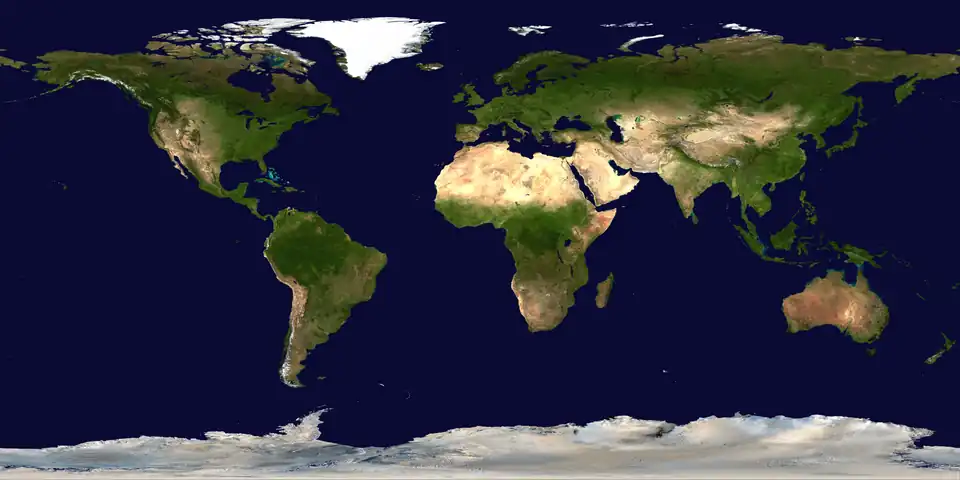
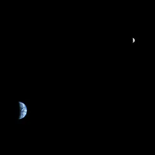
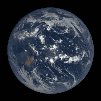
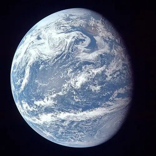
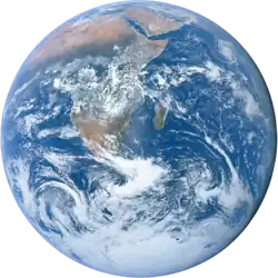
 Image of the physical world, captured by the Hubble Space Telescope (from World)
 -
.png) Cuneiform inscription, eastern Turkey
Cuneiform inscription, eastern Turkey -
 13th-century French historiated initial with the three classes of medieval society: those who prayed (the clergy), those who fought (the knights), and those who worked (the peasantry)
 -
 COVID-19 pandemic, 2020 (from Human history)
 -
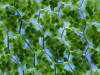 Chloroplasts in the cells of a moss (from History of Earth)
 -
 Artist's conception of Hadean Eon Earth, when it was much hotter and inhospitable to all forms of life. (from History of Earth)
 -
-
 Earth's axial tilt causing different angles of seasonal illumination at different orbital positions around the Sun (from Earth)
 -
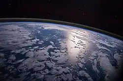
 Tracy Caldwell Dyson, a NASA astronaut, observing Earth from the Cupola module at the International Space Station on 11 September 2010 (from Earth)
 -
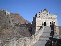 Ming dynasty section, Great Wall of China
 -
 Portrait of Alfraganus in the Compilatio astronomica, 1493. Islamic astronomers began just before the 9th century to collect and translate Indian, Persian and Greek astronomical texts, adding their own astronomy and enabling later, particularly European astronomy to build on. Symbolic for the post-classical period, a period of an increasing trans-regional literary culture, particularly in the sciences, spreading and building on methods of science. (from Human history)
 -
 Benin Bronze head from Nigeria
 -
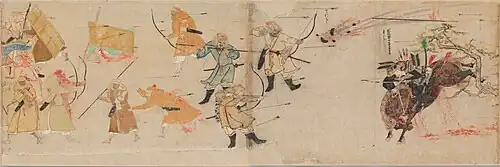 Battle during the 1281 Mongol invasion of Japan
 -
.jpg) Vitruvian Man by Leonardo da Vinci epitomizes the advances in art and science seen during the Renaissance. (from History of Earth)
Vitruvian Man by Leonardo da Vinci epitomizes the advances in art and science seen during the Renaissance. (from History of Earth) -
 Florence, birthplace of the Italian Renaissance
 -
 Empires of the world in 1898
 -
-
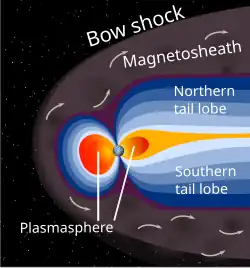 A schematic view of Earth's magnetosphere with solar wind flowing from left to right (from Earth)
 -
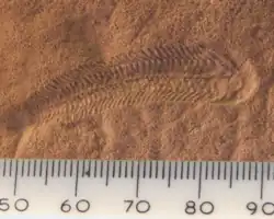 A 580 million year old fossil of Spriggina floundensi, an animal from the Ediacaran period. Such life forms could have been ancestors to the many new forms that originated in the Cambrian Explosion. (from History of Earth)
 -
 A view of Earth with different layers of its atmosphere visible: the troposphere with its clouds casting shadows, a band of stratospheric blue sky at the horizon, and a line of green airglow of the lower thermosphere around an altitude of 100 km, at the edge of space (from Earth)
 -
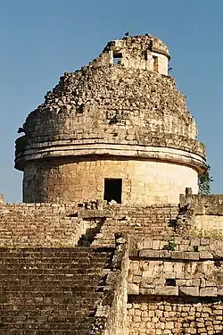
 Machu Picchu, Inca Empire, Peru
 -
 A reconstruction of Pannotia (550 Ma). (from History of Earth)
 -
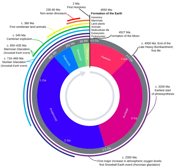 Earth's history with time-spans of the eons to scale. Ma means "million years ago". (from History of Earth)
 -
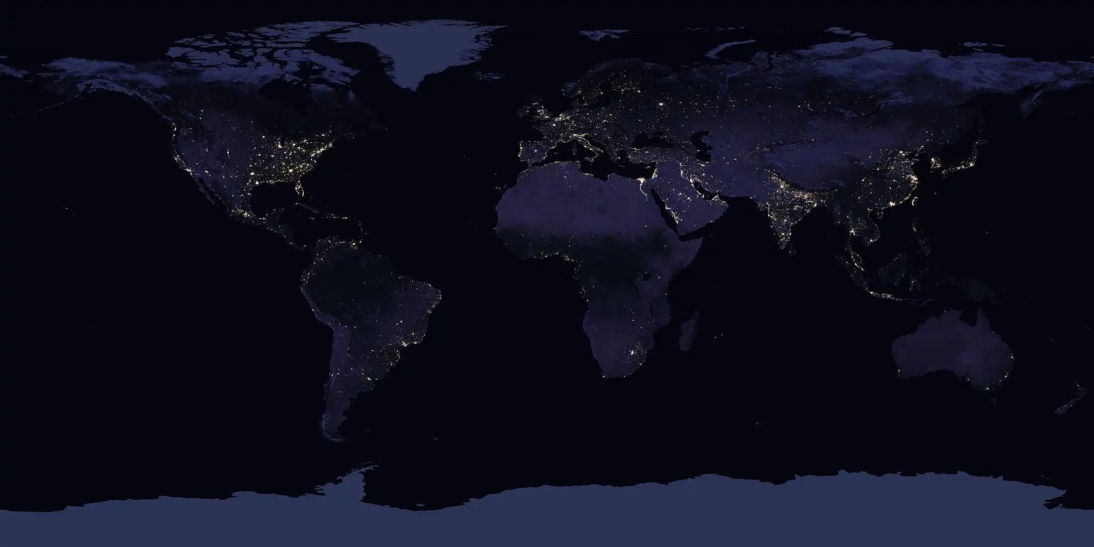 A composite image of artificial light emissions at night on a map of Earth (from Earth)
 -
 An artist's rendering of a protoplanetary disk (from History of Earth)
 -
 Satellite time lapse imagery of Earth's rotation showing axis tilt (from Earth)
 -
-
.jpg) The first airplane, the Wright Flyer, flew on 17 December 1903.
The first airplane, the Wright Flyer, flew on 17 December 1903. -
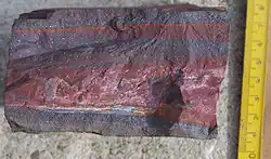 A banded iron formation from the 3.15 Ga Moodies Group, Barberton Greenstone Belt, South Africa. Red layers represent the times when oxygen was available; gray layers were formed in anoxic circumstances. (from History of Earth)
 -
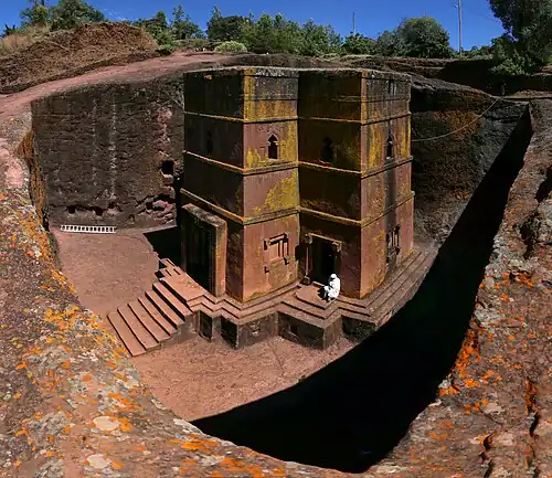 One of the eleven Rock-hewn Churches of Lalibela constructed during the Zagwe dynasty in Ethiopia (from Human history)
 -
 Fall of the Berlin Wall, 1989
 -
.jpeg) Standing Buddha from Gandhara, 2nd century CE
Standing Buddha from Gandhara, 2nd century CE -
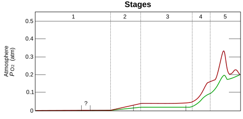 Graph showing range of estimated partial pressure of atmospheric oxygen through geologic time (from History of Earth)
 -
-
 The pale orange dot, an artist's impression of the early Earth which might have appeared orange through its hazy methane rich prebiotic second atmosphere. Earth's atmosphere at this stage was somewhat comparable to today's atmosphere of Titan. (from History of Earth)
 -
 Change in average surface air temperature and drivers for that change. Human activity has caused increased temperatures, with natural forces adding some variability. (from Earth)
 -
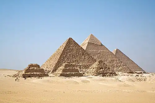 Great Pyramids of Giza, Egypt
 -
-
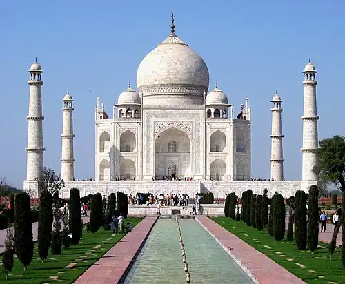 Taj Mahal, Mughal Empire, India
 -
 The replicator in virtually all known life is deoxyribonucleic acid. DNA is far more complex than the original replicator and its replication systems are highly elaborate. (from History of Earth)
 -
 Yggdrasil, an attempt to reconstruct the Norse world tree which connects the heavens, the world, and the underworld. (from World)
 -
 Notre-Dame de Paris, France
 -
 Pillar erected by Ashoka, a Mauryan Emperor in India
 -
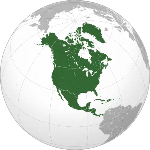
 Geologic map of North America, color-coded by age. From most recent to oldest, age is indicated by yellow, green, blue, and red. The reds and pinks indicate rock from the Archean.
 -
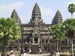 Angkor Wat temple complex, Cambodia, early 12th century
 -
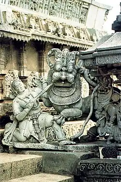 Chennakesava Temple, Belur, India
 -
 Shanghai. China urbanized rapidly in the 21st century.
 -
 Olmec colossal head, now at the Museo de Antropología de Xalapa
 -
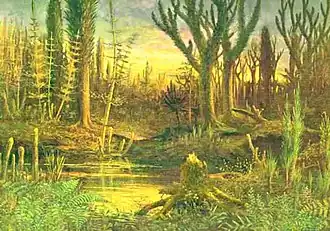 Artist's conception of Devonian flora (from History of Earth)
 -
-
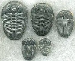 Trilobites first appeared during the Cambrian period and were among the most widespread and diverse groups of Paleozoic organisms. (from History of Earth)
 -
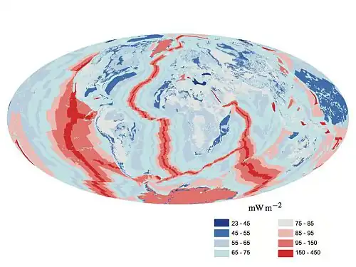 A map of heat flow from Earth's interior to the surface of Earth's crust, mostly along the oceanic ridges (from Earth)
 -
 Artist's rendition of an oxinated fully-frozen Snowball Earth with no remaining liquid surface water. (from History of Earth)
 -
 European migrations by mostly Germanic peoples, 2nd–6th centuries (from Human history)
 -
 An artist's impression of the Archean, the eon after Earth's formation, featuring round stromatolites, which are early oxygen-producing forms of life from billions of years ago. After the Late Heavy Bombardment, Earth's crust had cooled, its water-rich barren surface is marked by continents and volcanoes, with the Moon still orbiting Earth half as far as it is today, appearing 2.8 times larger and producing strong tides. (from Earth)
 -
 Carving of Persian and Median soldiers, Persepolis, Achaemenid Empire, 5th century BCE
 -
-
 Earth's night-side upper atmosphere appearing from the bottom as bands of afterglow illuminating the troposphere in orange with silhouettes of clouds, and the stratosphere in white and blue. Next the mesosphere (pink area) extends to the orange and faintly green line of the lowest airglow, at about one hundred kilometers at the edge of space and the lower edge of the thermosphere (invisible). Continuing with green and red bands of aurorae stretching over several hundred kilometers. (from Earth)
 -
Pale orange dot, an artist's impression of Early Earth, featuring its tinted orange methane-rich early atmosphere (from Earth)
-
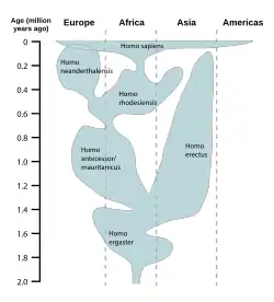
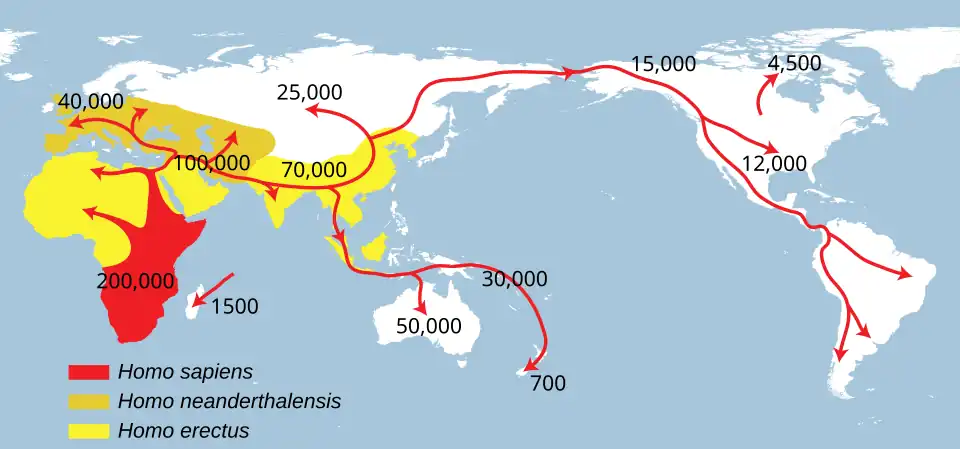 Successive dispersals of Homo erectus (yellow), Homo neanderthalensis (ochre) during Out of Africa I and Homo sapiens (red, Out of Africa II), with the numbers of years since they appeared before present. (from Human history)
 -
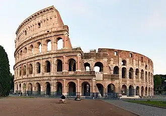 The Colosseum in Rome (from Human history)
 -
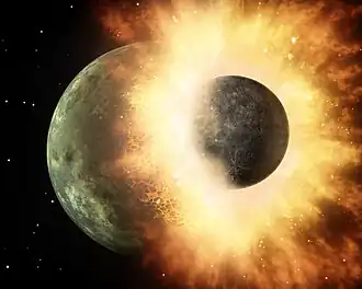 Artist's impression of the enormous collision that probably formed the Moon (from History of Earth)
 -
.svg.png)
-
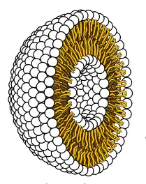 Cross-section through a liposome (from History of Earth)
 -
 A pillar at Neolithic Göbekli Tepe
 -
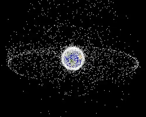 A computer-generated image mapping the prevalence of artificial satellites and space debris around Earth in geosynchronous and low Earth orbit (from Earth)
 -
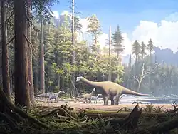 Dinosaurs were the dominant terrestrial vertebrates throughout most of the Mesozoic (from History of Earth)
 -
-
 An animation of the changing density of productive vegetation on land (low in brown; heavy in dark green) and phytoplankton at the ocean surface (low in purple; high in yellow) (from Earth)
 -
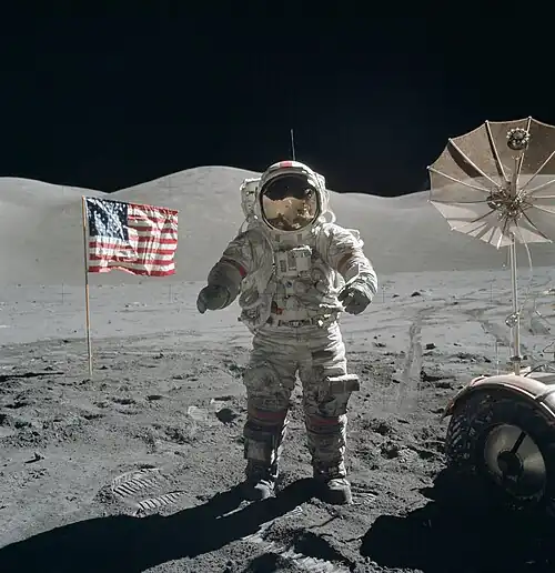 Last Moon landing: Apollo 17 (1972)
 -
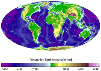
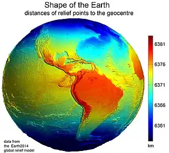 Earth's western hemisphere showing topography relative to Earth's center instead of to mean sea level, as in common topographic maps (from Earth)
 -
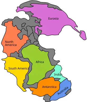 Pangaea was a supercontinent that existed from about 300 to 180 Ma. The outlines of the modern continents and other landmasses are indicated on this map. (from History of Earth)
 -
Artist's impression of Earth during the later Archean, the largely cooled planetary crust and water-rich barren surface, marked by volcanoes and continents, features already round microbialites. The Moon, still orbiting Earth much closer than today and still dominating Earth's sky, produced strong tides. (from History of Earth)
-
 Earth's land use for human agriculture in 2019 (from Earth)
 -
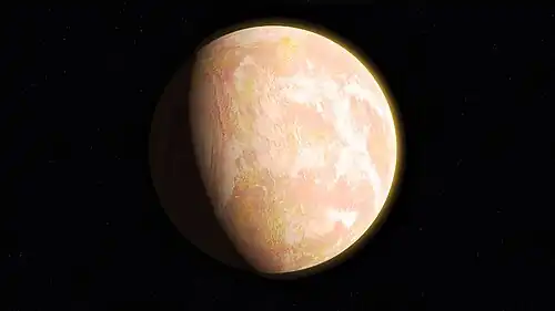
A 2012 artistic impression of the early Solar System's protoplanetary disk from which Earth and other Solar System bodies were formed (from Earth)
-
-
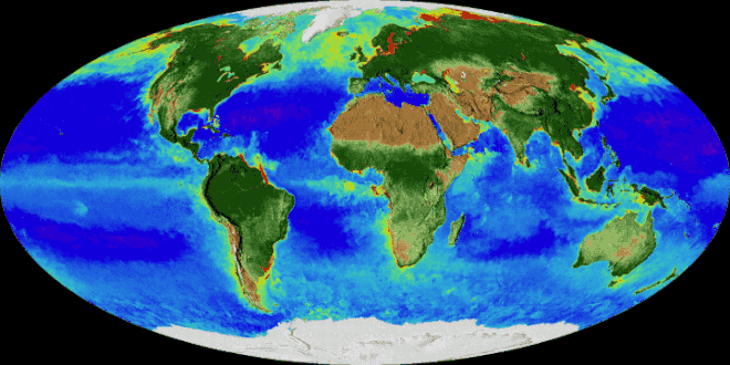
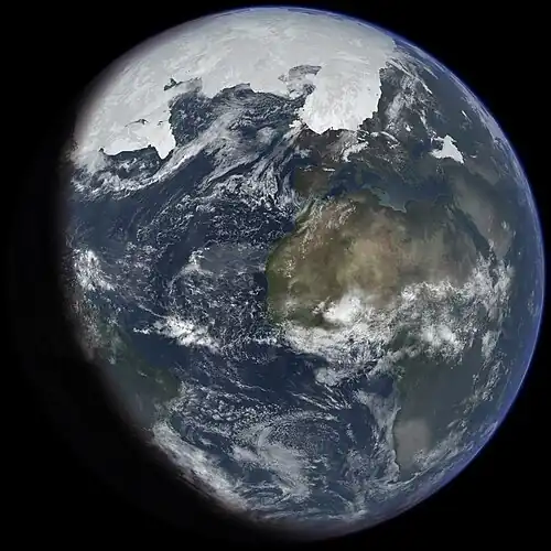
 A composite image of Earth, with its different types of surface discernible: Earth's surface dominating Ocean (blue), Africa with lush (green) to dry (brown) land and Earth's polar ice in the form of Antarctic sea ice (grey) covering the Antarctic or Southern Ocean and the Antarctic ice sheet (white) covering Antarctica. (from Earth)
 -
 A reconstruction of human history based on fossil data. (from History of Earth)
 -
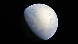
 An artist's impression of ice age Earth at glacial maximum. (from History of Earth)
 -
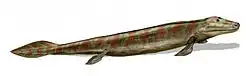 Tiktaalik, a fish with limb-like fins and a predecessor of tetrapods. Reconstruction from fossils about 375 million years old. (from History of Earth)
 -
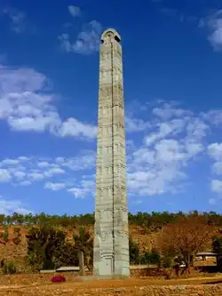 Obelisk of Axum, Ethiopia
 -
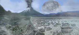
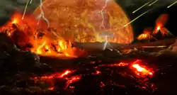 Artist's impression of a Hadean landscape with the relatively newly formed Moon still looming closely over Earth and both bodies sustaining strong volcanism. (from History of Earth)
 -
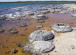 Lithified stromatolites on the shores of Lake Thetis, Western Australia. Archean stromatolites are the first direct fossil traces of life on Earth. (from History of Earth)
 -
-
-
-
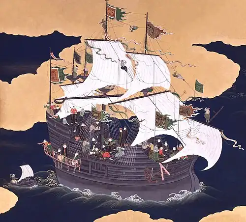 Japanese depiction of a Portuguese carrack, a result of globalizing maritime trade
 -
 A view of Earth with its global ocean and cloud cover, which dominate Earth's surface and hydrosphere; at Earth's polar regions, its hydrosphere forms larger areas of ice cover. (from Earth)
Megacities of the world -
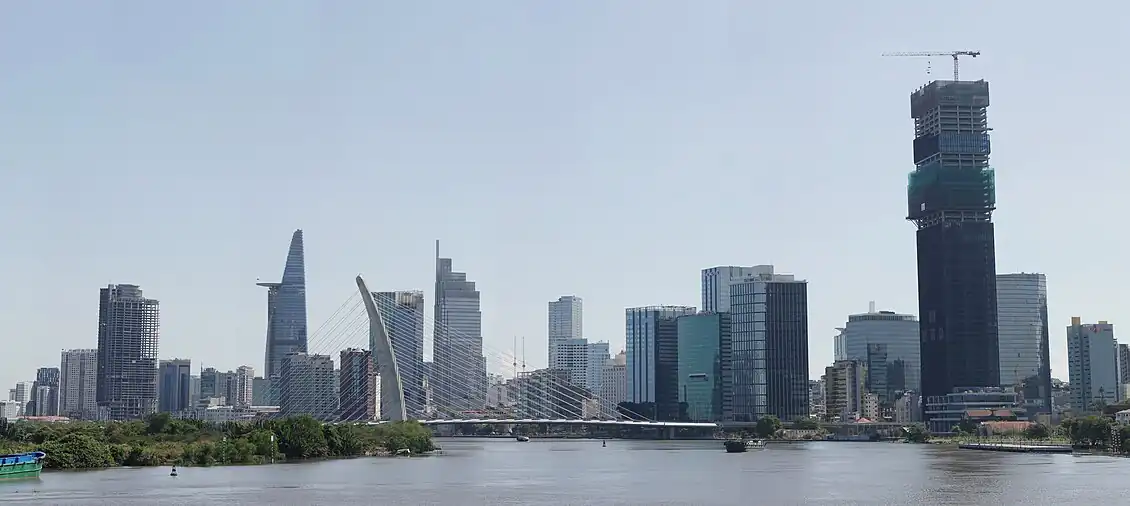
Ho Chi Minh City (HCMC; Vietnamese: Thành phố Hồ Chí Minh, IPA: [tʰan˨˩ fow˦˥ how˨˩ cɪj˦˥ mɨn˧˧]), also known as Saigon (Vietnamese: Sài Gòn, IPA: [saːj ɣɔ̂n]), is the most populous city in Vietnam with a population of 14,002,598 in 2025.
The city's geography is defined by rivers and canals, of which the largest is Saigon River. As the largest financial centre in Vietnam, Ho Chi Minh City has the largest gross regional domestic product out of all Vietnam provinces and municipalities, contributing around a quarter of the country's total GDP. Ho Chi Minh City's metropolitan area is ASEAN's 5th largest economy, also the biggest outside an ASEAN country capital. (Full article...)
Did you know -

- ... that the founder of the Guide to the Free World, helping people leave Russia after its invasion of Ukraine, said she was told: "It's good that you get out of Russia, but a pity that you won't be shot"?
- ... that Lord Cottenham resigned from MI5 during the Second World War, as he did not support the war with Germany?
- ... that Olympic silver medallist Eduard von Lütcken captured a Russian general before being killed in an early action of the First World War?
- ... that a photograph of Chili Williams, known as the "Polka Dot Girl", was one of the "two most famous pin-up pictures" of World War II?
- ... that Beryl Benacerraf, pioneer of the nuchal scan, wrote that dyslexia caused her to live in a world of images where "anomalies jump out at me like a neon sign"?
- ... that the Hôtel Gabriel was rebuilt after its destruction in World War II?
- ... that Paul Huff Parkway is named after a U.S. Army soldier who was awarded the Medal of Honor while serving in World War II?
- ... that a horse in an episode of The Last of Us previously appeared in The 100 and Jurassic World Dominion?
Countries of the world -

The Marshall Islands, officially the Republic of the Marshall Islands, is an island country west of the International Date Line and north of the equator in the Micronesia region of the Northwestern Pacific Ocean.
The territory consists of 29 coral atolls and five main islands as well as 1,220 other very small ones, divided across two island chains: Ratak in the east and Ralik in the west. 98.13% of its territory is water, the largest proportion of water to land of any sovereign state. The country shares maritime boundaries with Wake Island to the north, Kiribati to the southeast, Nauru to the south, and the Federated States of Micronesia to the west. The capital and largest city is Majuro, home to approximately half of the country's population. The Marshall Islands are one of only four atoll based nations in the entire world. (Full article...)
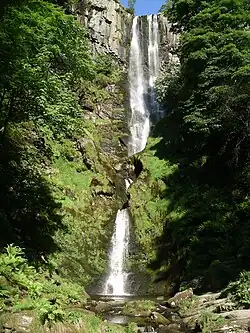
The Seven Wonders of Wales (Welsh: Saith Rhyfeddod Cymru) is a traditional list of notable landmarks in north Wales, commemorated in an anonymously written rhyme:
The rhyme is usually supposed to have been written sometime in the late 18th or early 19th century by an English visitor to North Wales. The specific number of wonders may have varied over the years: the antiquary Daines Barrington, in a letter written in 1770, refers to Llangollen Bridge as one of the "five wonders of Wales, though like the seven wonders of Dauphiny, they turn out to be no wonders at all out of the Principality". (Full article...)
Related portals
Protected areas of the world -
-
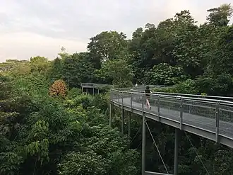
There are numerous parks throughout the sovereign island country of Singapore. This is a list of parks in Singapore that currently exist and have articles on Wikipedia. Most parks in Singapore are managed by the National Parks Board, although smaller, neighbourhood parks are managed by the Housing Development Board. Most of these parks are connected via the Park Connector Network (PCN) walking/running/cycling paths. (Full article...) -
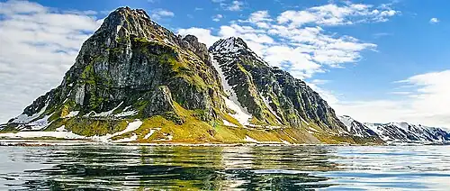
The northernmost tip of Prins Karls Forland in Forlandet National Park
Svalbard is an Arctic wilderness archipelago comprising the northernmost part of Norway. There are twenty-nine protected natural areas, consisting of seven national parks, six nature reserves, fifteen bird sanctuaries and one geotope protected area. In addition, human traces dating from before 1946 are automatically protected. The protected areas make up 39,800 square kilometers (15,400 sq mi) or 65% of the land area, and 78,000 square kilometers (30,000 sq mi) or 86.5% of the territorial waters. The largest protected areas are Nordaust-Svalbard Nature Reserve and Søraust-Svalbard Nature Reserve, which cover most of the areas east of the main island of Spitsbergen, including the islands of Nordaustlandet, Edgeøya, Barentsøya, Kong Karls Land and Kvitøya. Six of the national parks are located on Spitsbergen. Ten of the bird sanctuaries and the Moffen Nature Reserve are located within national parks. Five of the bird sanctuaries are Ramsar sites and fourteen of the bird sanctuaries are islands. Svalbard is on Norway's tentative list for nomination as a UNESCO World Heritage Site.
The supreme responsibility for conservation lies with the Norwegian Ministry of the Environment, which has delegated the management to the Governor of Svalbard and the Norwegian Directorate for Nature Management. The foundation for conservation was established in the Svalbard Treaty of 1920, and has been further specified in the Svalbard Environmental Act of 2001. The first round of protection took force on 1 July 1973, when most of the current protected areas came into effect. This included the two large nature reserves and three of the national parks. Moffen Nature Reserve was established in 1983, followed by four national parks, three nature reserves and one geotope protection area between 2002 and 2005. (Full article...) -
There are four categories of protected areas in India, constituted under the Wildlife Protection Act, 1972. Tiger reserves consist of areas under national parks and wildlife sanctuaries. There are 53 tiger reserves in India. As of January 2023, the protected areas of India cover 173,629.52 square kilometres (67,038.73 sq mi), roughly 5.28% of the total geographical area of the country. (Full article...)
-
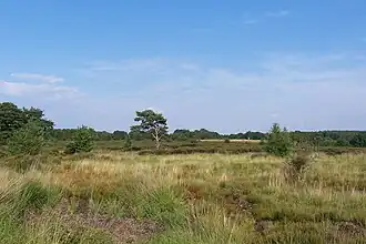
Heathland at the Hoge Kempen National Park
There are numerous protected areas in Belgium with a wide variety of types, protection levels and sizes. The below list gives an overview of the most important protected areas. (Full article...) -
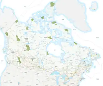
The following list of protected areas of British Columbia includes all federally and provincially protected areas within the Canadian province of British Columbia. As of 2015, approximately 15.46% of the province's land area and 3.17% of the province's waters are protected. (Full article...)
-
-
Total size of protected area of Bosnia and Herzegovina amounts of 57.83694 hectares (142.9182 acres), which is 1,13% of its entire territory. This is a list of areas protected by corresponding levels of the government of Bosnia and Herzegovina, namely at the entity's levels, and with various categorizations. (Full article...) -
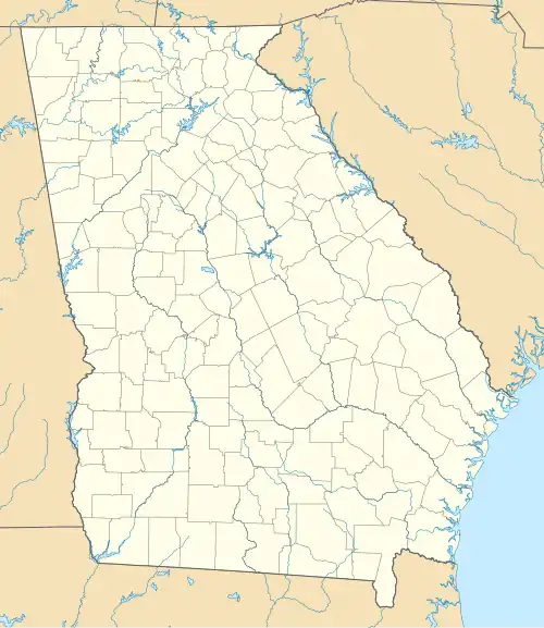
Map of Georgia
The protected areas of Georgia cover almost one million acres (4,000 km2) of the state. These areas are managed by different federal and state level authorities and receive varying levels of protection. Some areas are managed as wilderness while others are operated with acceptable commercial exploitation. On the Federal level, Georgia contains 1 Biosphere Reserve, 15 National Park Service Managed Sites, 1 National Forest and 8 Wildlife Refuges. Georgia is home to 63 state parks, 48 of which are state parks and 15 that are National Historic Sites, and many state wildlife preserves, under the supervision of the Georgia Department of Parks and Recreation, a division of the Georgia Department of Natural Resources. (Full article...) -
Protected areas of the Caribbean are significant in a region of particular ecological vulnerability, including the impact of climate change and the impact of tourism.
The University of the West Indies' "Caribbean Protected Areas Gateway" supports informational resources for the 16 Caribbean member states of the Organisation of African, Caribbean and Pacific States. It forms the regional component of the ACP's Biodiversity and Protected Areas Management program, building on the World Database on Protected Areas. (Full article...) -
The Protected areas of Portugal (Portuguese: Áreas protegidas de Portugal) are classified under a legal protection statute that allows for the adequate protection and maintenance of biodiversity, while providing services for ecosystem that maintains the natural and geological patrimony. (Full article...)
-
Cadw is the historic environment service of the Welsh Government which manages historical buildings and ancient monuments in Wales. (Full article...)
-
.jpg)
Llyn y Fan Fach in the Brecon Beacons, one of Wales's three national parks
Wales, a country that is part of the United Kingdom, contains protected areas under various designations. The largest designation by land area is Wales's three national parks, followed by the five Areas of Outstanding Natural Beauty (sometimes collectively the "Designated Landscapes of Wales").
Among these protected areas is Snowdonia (Eryri), Wales's first and the UK's third designated national park, and the Gower AONB covering parts of the Gower Peninsula being both Wales's and the UK's first Area of Outstanding Natural Beauty (AONB), as well as smaller designations. (Full article...) -
-
This is a list of the nationally designated protected areas of China. There are many forms of protected areas in China. Based on their relative importance, each type of protected area can be further graded into two to three levels (national, provincial and prefectural/county level). Nevertheless, the highest rank for "pocket nature preserve" (social and mass-based), "no-hunting area", "no-fishing area", "no-logging area", "wild medicinal material resources conservation area", "crop germplasm resources conservation area", "forest tree germplasm resources conservation area" or "source water protection area" is practically restricted to provincial level. The local government at county level is also responsible for the delimitation and declaration of "basic farmland protection area" and "basic grassland".
Take note that many protected areas in China have multiple official designations, and the statutory boundaries of these multi-designated PAs may be identical or may vary one from the other. For instance, the boundaries of Huangshan NSHA coincide with those of the Huangshan NGP, whereas Fujian province's Wuyi Mountains NNR, NSHA and NFP are adjacent to each other. In Heilongjiang, 27,642.14 hectares out of 115,340.27 hectares of Huzhong NFP are intersected with the experiment zone of Huzhong NNR. (Full article...) -
The country of Burundi in Africa has the following national parks and other protected areas. (Full article...)
Selected world maps
-
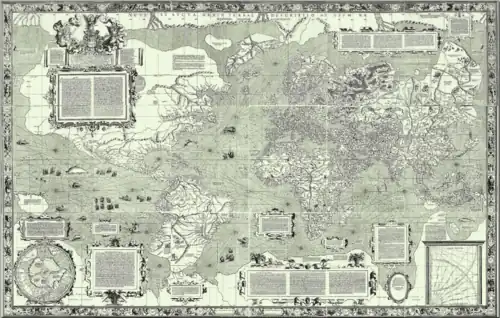 The world map by Gerardus Mercator (1569), the first map in the well-known Mercator projection
 -
 1516 map of the world by Martin Waldseemüller
 -
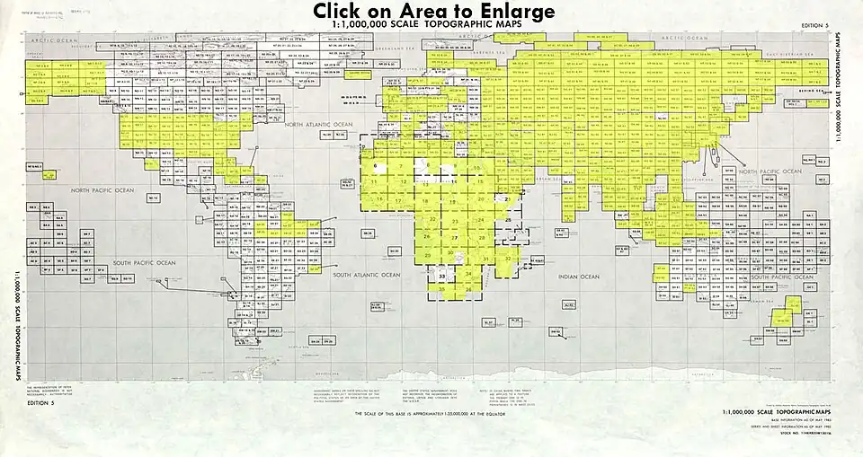 Index map from the International Map of the World (1:1,000,000 scale)
 -
 Mollweide projection of the world
 -
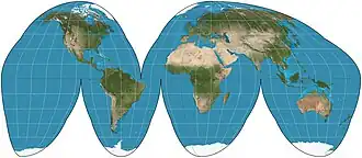 The Goode homolosine projection is a pseudocylindrical, equal-area, composite map projection used for world maps.
 -
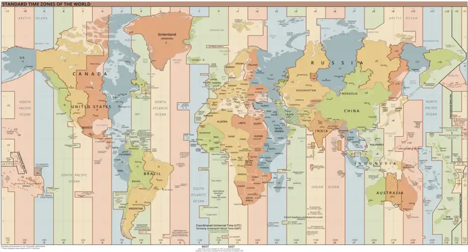 Time zones of the world
 -
 United Nations Human Development Index map by country (2016)
 -
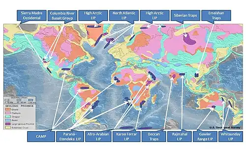 Only a few of the largest large igneous provinces appear (coloured dark purple) on this geological map, which depicts crustal geologic provinces as seen in seismic refraction data
 -
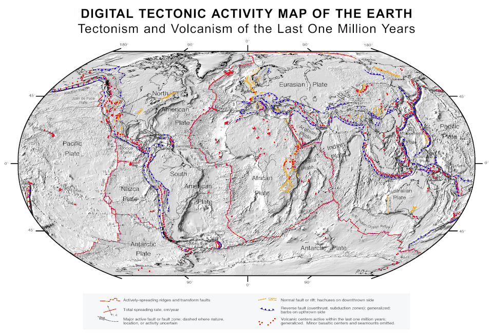 A plate tectonics map with volcano locations indicated with red circles
World records
- List of Olympic records in athletics
- List of world records in athletics
- List of junior world records in athletics
- List of world records in masters athletics
- List of world youth bests in athletics
- List of IPC world records in athletics
- List of world records in canoeing
- List of world records in chess
- List of cycling records
- List of world records in track cycling
- List of world records in finswimming
- List of world records in juggling
- List of world records in rowing
- List of world records in speed skating
- List of world records in swimming
- List of IPC world records in swimming
- List of world records in Olympic weightlifting
Topics
Continents of Earth | ||||||||
|---|---|---|---|---|---|---|---|---|
| ||||||||
| ||||||||
| ||||||||
.svg.png)
.svg.png)
.svg.png)
.svg.png)

.svg.png)
_political.svg.png)
.svg.png)
.svg.png)
.svg.png)
| Cenozoic Era (present–66.0 Ma) |
| ||||||||||||
|---|---|---|---|---|---|---|---|---|---|---|---|---|---|
| Mesozoic Era (66.0–252 Ma) |
| ||||||||||||
| Paleozoic Era (252–539 Ma) |
| ||||||||||||
| Proterozoic Eon (539 Ma–2.5 Ga) |
| ||||||||||||
| Archean Eon (2.5–4 Ga) | |||||||||||||
| Hadean Eon (4–4.6 Ga) | |||||||||||||
ka = kiloannum (thousand years ago); Ma = megaannum (million years ago); Ga = gigaannum (billion years ago). See also: Geologic time scale • | |||||||||||||
| Locations | ||
|---|---|---|
| Related | ||
| |||||||||||||||||||
| |||||||||||||||||||
| |||||||||||||||||||
Economic classification of countries | |||||
|---|---|---|---|---|---|
| Three-World Model | |||||
| Gross domestic product (GDP) |
| ||||
| Gross national income (GNI) | |||||
| Wages | |||||
| Wealth | |||||
| Other national accounts | |||||
| Human development | |||||
| Digital divide | |||||
| Net international investment position (NIIP) | |||||
| Technological |
| ||||
|---|---|---|---|---|---|
| Sociological | |||||
| Ecological |
| ||||
| Biological |
| ||||
| Astronomical | |||||
| Eschatological |
| ||||
| Others |
| ||||
| Fictional | |||||
| Organizations | |||||
| |||||
Categories

Wikimedia
The following Wikimedia Foundation sister projects provide more on this subject:
-
 Commons
Free media repository -
 Wikibooks
Free textbooks and manuals -
 Wikidata
Free knowledge base -
 Wikinews
Free-content news -
 Wikiquote
Collection of quotations -
 Wikisource
Free-content library -
 Wikispecies
Directory of species -
 Wikiversity
Free learning tools -
 Wikivoyage
Free travel guide -
 Wiktionary
Dictionary and thesaurus
More portals
-
 List of all portals
 -

-

-

-
-

-

-

-

-

-
 Random portal
 -
 WikiProject Portals