Santon Downham
| Santon Downham | |
|---|---|
 Church of St Mary | |
 Santon Downham Location within Suffolk | |
| Population | 237 (2011)[1] |
| District | |
| Shire county | |
| Region | |
| Country | England |
| Sovereign state | United Kingdom |
| Post town | Brandon |
| Postcode district | IP27 |
| Dialling code | 01842 |
| Police | Suffolk |
| Fire | Suffolk |
| Ambulance | East of England |
| UK Parliament | |
Santon Downham is a village and civil parish in the West Suffolk district of Suffolk in eastern England. In 2005 it had a population of 240.[2] The village is located within Thetford Forest on a meander of the River Little Ouse on the Norfolk-Suffolk border. Thetford is 4 miles (6 km) southeast and the nearest railway station is in Brandon 2 miles (3 km) west.
History
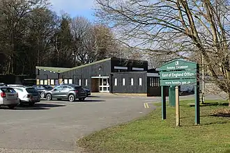
The village was the administrative centre for the Eastern Forestry Commission for many years, following the planting of tens of thousands of trees in the Breckland to form the Thetford Forest. The District office and staff were housed in a 1960s office building close to the site of the now-demolished Downham Hall. The Hall garden formed the base for the nursery department of the district. The Forestry Commission repair depot was built close by in an award-winning building, next to which stood the Forestry Commission fire station. A Bedford 'Green Goddess' fire tender and a water tanker were kept in the fire station due to the high fire risk in the area.
In 1972 the bridge over the River Little Ouse appeared in programme 50 of the fifth series of BBC's sitcom Dad's Army, when Captain Mainwaring and his troops attempt to demolish it.[3][4]
Climate
Santon Downham has an oceanic climate (Köppen: Cfb).
| Climate data for Santon Downham (6 m or 20 ft asl, averages 1991–2020, extremes 1959-present) | |||||||||||||
|---|---|---|---|---|---|---|---|---|---|---|---|---|---|
| Month | Jan | Feb | Mar | Apr | May | Jun | Jul | Aug | Sep | Oct | Nov | Dec | Year |
| Record high °C (°F) | 16.7 (62.1) |
19.4 (66.9) |
25.0 (77.0) |
28.2 (82.8) |
28.8 (83.8) |
34.6 (94.3) |
39.0 (102.2) |
35.3 (95.5) |
31.7 (89.1) |
29.3 (84.7) |
18.8 (65.8) |
16.0 (60.8) |
39.0 (102.2) |
| Mean daily maximum °C (°F) | 7.8 (46.0) |
8.5 (47.3) |
11.2 (52.2) |
14.4 (57.9) |
17.7 (63.9) |
20.4 (68.7) |
22.9 (73.2) |
22.6 (72.7) |
19.5 (67.1) |
15.2 (59.4) |
10.9 (51.6) |
8.0 (46.4) |
14.9 (58.9) |
| Mean daily minimum °C (°F) | 0.8 (33.4) |
0.7 (33.3) |
1.7 (35.1) |
3.2 (37.8) |
6.1 (43.0) |
9.2 (48.6) |
11.3 (52.3) |
11.1 (52.0) |
8.7 (47.7) |
6.1 (43.0) |
3.0 (37.4) |
1.0 (33.8) |
5.2 (41.4) |
| Record low °C (°F) | −18.9 (−2.0) |
−15.0 (5.0) |
−12.2 (10.0) |
−9.7 (14.5) |
−7.7 (18.1) |
−5.6 (21.9) |
−1.1 (30.0) |
−1.7 (28.9) |
−5.6 (21.9) |
−8.7 (16.3) |
−11.1 (12.0) |
−16.1 (3.0) |
−18.9 (−2.0) |
| Average rainfall mm (inches) | 54.4 (2.14) |
44.3 (1.74) |
45.5 (1.79) |
40.7 (1.60) |
46.9 (1.85) |
60.1 (2.37) |
58.8 (2.31) |
65.2 (2.57) |
55.1 (2.17) |
67.3 (2.65) |
65.9 (2.59) |
62.1 (2.44) |
666.3 (26.22) |
| Average rainy days (≥ 1 mm) | 11.2 | 10.4 | 9.5 | 8.9 | 8.5 | 9.5 | 9.5 | 9.6 | 9.0 | 10.7 | 11.9 | 11.8 | 120.5 |
| Mean monthly sunshine hours | 50.1 | 75.9 | 108.0 | 162.3 | 198.0 | 186.2 | 198.9 | 190.9 | 135.4 | 103.6 | 63.5 | 53.9 | 1,526.7 |
| Source 1: Met Office[5] | |||||||||||||
| Source 2: Starlings Roost Weather[6] | |||||||||||||
The highest temperature since records began in 1959 was 39.0 °C (102.2 °F) on 19 July 2022 and the lowest was −18.9 °C (−2.0 °F) on 23 January 1963.[7]
Santon Downham is a known frost hollow and on 1 and 3 June 1962 it recorded the UK's lowest June temperature on record with −5.6 °C (21.9 °F), a record it also shares with Dalwhinnie in the highlands of Scotland.[8] The temperature can go below freezing at any time of the year.
Transport
The Santon Downham Tramway was a 6-kilometre (3.7 mi) long narrow-gauge railway, which was operated around 1918 to 1922.
See also
References
- ^ "Civil Parish population 2011". Neighbourhood Statistics. Office for National Statistics. Retrieved 27 August 2016.
- ^ Estimates of Total Population of Areas in Suffolk Archived 2008-12-19 at the Wayback Machine Suffolk County Council
- ^ "Dad's Army filming locations - Santon Downham - Find That Location".
- ^ "Dad's Army – Santon Downham".
- ^ "Santon Downham UK climate averages". Met Office. Archived from the original on 22 September 2021. Retrieved 22 September 2021.
- ^ "Monthly Temperature Extremes". Roost Weather. Retrieved 2 August 2025.
{{cite web}}: CS1 maint: url-status (link) - ^ https://www.roostweather.com/ukobs/temp_station_extreme_map.php
- ^ https://www.metoffice.gov.uk/research/climate/maps-and-data/uk-climate-extremes
External links
- Village website
- Village Hall website
- Parish Council website
- Explore Santon Downham at forestry.gov.uk
 Media related to Santon Downham at Wikimedia Commons