Seredyna-Buda
Seredyna-Buda
Середина-Буда | |
|---|---|
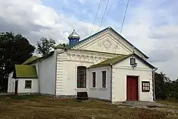 Saint Nicholas Church | |
 Coat of arms | |
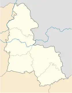 Seredyna-Buda Location of Seredyna-Buda  Seredyna-Buda Seredyna-Buda (Ukraine) | |
| Coordinates: 52°11′09″N 34°02′18″E / 52.18583°N 34.03833°E | |
| Country | |
| Oblast | Sumy Oblast |
| Raion | Shostka Raion |
| Hromada | Seredyna-Buda urban hromada |
| Founded | 1650 |
| Government | |
| • Mayor | Oleksandr Hryhorovych |
| Area | |
• Total | 27.03 km2 (10.44 sq mi) |
| Population (2001) | |
• Total | 7,500 |
| Postal code | 41000 |
| Website | https://web.archive.org/web/20140222101001/http://s-buda.gov.ua/ |
Seredyna-Buda (Ukrainian: Середина-Буда) is a city in Shostka Raion of Sumy Oblast of northeastern Ukraine. It was the administrative center of Seredyna-Buda Raion until it was abolished on 18 July 2020.[1] It is located on Bryansk to Konotop branch line and is served by the railway station Zernove. Population: 6,888 (2022 estimate).[2] In 2001, the population was 7,500.[3]
Geography
Seredina-Buda is located on the border of Ukraine with Russia, on the slopes of the Central Russian Upland. The climate is moderately continental. Winter is cool, summer is not hot. The average temperature in July is +19 °C, in January -7.5 °C. The maximum amount of precipitation falls in the summer in the form of rain. The average annual amount is from 650 mm. [4][5]
Seredina-Buda is located in the Desna River basin (Dnieper basin). The territory is covered with coniferous and deciduous forests. The most common forests are pine, oak-linden and oak. The forests are rich in mushrooms and berries.[5][4]
History
.jpg)
Seredyna-Buda was founded in the 17th century by Old Believers migrated from Russia. It has had town status since 1964.[6]
As of May 17, 2022, it was one of the cities in the territory where active hostilities with Russian Armed Forces were conducted during the Russian invasion of Ukraine.[7][8]
Demographics
As of the 2001 Ukrainian census, Seredyna-Buda had a population of 7,526 inhabitants. Ethnic Ukrainians constitute a strong majority, yet Russian is most common language in the settlement due to its proximity to the Russian border. The exact ethnic and linguistic composition was as follows:[9][10]
References
- ^ "Про утворення та ліквідацію районів". Офіційний вебпортал парламенту України (in Ukrainian). Archived from the original on 2020-07-21. Retrieved 2023-12-29.
- ^ Чисельність наявного населення України на 1 січня 2022 [Number of Present Population of Ukraine, as of January 1, 2022] (PDF) (in Ukrainian and English). Kyiv: State Statistics Service of Ukraine. Archived (PDF) from the original on 4 July 2022.
- ^ "Кількість наявного населення. 2001". db.ukrcensus.gov.ua. Archived from the original on 2023-02-01. Retrieved 2025-07-04.
- ^ a b Географія Сумської області: особливості природи, соціально-економічного розвитку та раціонального природокористування Archived 2025-06-27 at the Wayback Machine: колективна монографія / За заг. ред. А. О. Корнуса. − Суми: СумДПУ імені А.С. Макаренка, 2021. − 212 с. Retrieved 2025-07-04
- ^ a b "Середина-Буда". maps.visicom.ua (in Ukrainian). Retrieved 2025-07-04.
- ^ "Історичні довідки". sbmiskrada.gov.ua (in Ukrainian). Retrieved 2025-07-04.
- ^ "Війна: хронологія подій у Сумській області. 24 лютого — 24 листопада 2022 року". ldn.org.ua (in Ukrainian). 2022-12-01. Archived from the original on 2025-05-13. Retrieved 2025-07-04.
- ^ "Оновили перелік територій, на яких ведуться бойові дії". Трибуна (in Ukrainian). Archived from the original on 2023-03-13. Retrieved 2025-07-04.
- ^ "Рідні мови в об'єднаних територіальних громадах України". socialdata.org.ua. Retrieved 2025-07-04.
- ^ "Національний склад міст". Datatowel.in.ua (in Ukrainian). Archived from the original on 2019-05-02. Retrieved 2025-04-07.