Shire of Belfast
| Shire of Belfast Victoria | |||||||||||||||
|---|---|---|---|---|---|---|---|---|---|---|---|---|---|---|---|
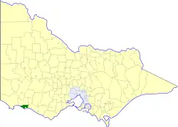 Location in Victoria | |||||||||||||||
| Population | 1,470 (1992)[1] | ||||||||||||||
| • Density | 0.2832/km2 (0.734/sq mi) | ||||||||||||||
| Established | 1853 | ||||||||||||||
| Area | 5,190 km2 (2,003.9 sq mi) | ||||||||||||||
| Council seat | Port Fairy | ||||||||||||||
| Region | Barwon South West | ||||||||||||||
| County | Villiers, Normanby | ||||||||||||||
| |||||||||||||||
The Shire of Belfast was a local government area about 290 kilometres (180 mi) west-southwest of Melbourne, the state capital of Victoria, Australia. The shire covered an area of 5,190 square kilometres (2,003.9 sq mi), and existed from 1853 until 1994.
History
Belfast was first incorporated as a road district on 29 June 1853, and became a shire on 8 December 1863.[2]
The shire contained no sizeable towns; the municipal office was in Port Fairy, next door to the Borough of Port Fairy's offices.[3] In 1992 the shire employed 13 full-time equivalent staff, one of the smallest municipal workforces in Victoria.[4]
On 23 September 1994, the Shire of Belfast was abolished, and along with the Borough of Port Fairy, the Shires of Minhamite and Mortlake, and parts of the Shires of Dundas, Mount Rouse, Warrnambool and the Tower Hill State Game Reserve, was merged into the newly created Shire of Moyne.[5]
Wards
The Shire of Belfast was divided into three ridings, each of which elected three councillors:
- Kirkstall Riding
- Moyne Riding
- Yambuk Riding
Towns and localities
Population
| Year | Population |
|---|---|
| 1954 | 1,949 |
| 1958 | 1,970* |
| 1961 | 1,917 |
| 1966 | 1,855 |
| 1971 | 1,643 |
| 1976 | 1,638 |
| 1981 | 1,503 |
| 1986 | 1,435 |
| 1991 | 1,412 |
* Estimate in the 1958 Victorian Year Book.
References
- ^ Australian Bureau of Statistics, Victoria Office (1994). Victorian Year Book. pp. 49–52. ISSN 0067-1223.
- ^ Victorian Municipal Directory. Brunswick: Arnall & Jackson. 1992. pp. 598–599. Accessed at State Library of Victoria, La Trobe Reading Room.
- ^ South West review: interim report. Melbourne: Local Government Board. 1994. p. 34.
- ^ Local governments side by side: comparative information on Victorian councils (2nd ed.). Melbourne: Office of Local Government, Department of Planning and Development. December 1993.
- ^ Australian Bureau of Statistics (1 August 1995). Victorian local government amalgamations 1994-1995: Changes to the Australian Standard Geographical Classification (PDF). Commonwealth of Australia. p. 10. ISBN 0-642-23117-6. Retrieved 5 January 2008.
External links
- Interactive map of Victorian local government areas (pre-1994 vs present) - Victorian Government - Digital Twin Victoria
- Victorian Places - Belfast Shire