Wasatch Mountain State Park
| Wasatch Mountain State Park | |
|---|---|
 | |
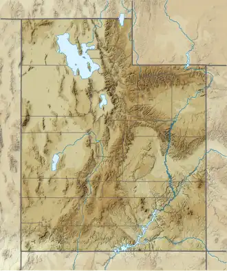 Location of Wasatch Mountain State Park within the State of Utah  Wasatch Mountain State Park (the United States) | |
| Location | Wasatch, Utah, United States |
| Coordinates | 40°30′10″N 111°32′14″W / 40.50278°N 111.53722°W |
| Area | 21,592 acres (87.38 km2) |
| Elevation | 5,900 ft (1,800 m) |
| Established | 1961 |
| Named for | the Wasatch Range |
| Visitors | 574,185 (in 2022)[1] |
| Operator | Utah Division of State Parks and Recreation |
| Website | stateparks |
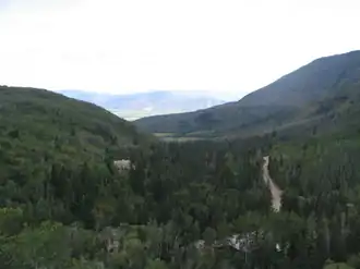
Wasatch Mountain State Park[2] is a state park of Utah, United States, in the northern part of the state within the Wasatch Back area on the north and west edges of the Heber Valley, in Wasatch County, near the city of Midway.
Description

Established in 1961, Wasatch Mountain State Park is Utah's most developed state park. Named for the Wasatch Mountains,[Note 1] the park consists of 21,592 acres (8,738 ha) and sits at an elevation of 5,900 feet (1,800 m).[5] Wildlife in the park includes deer, elk, wild turkeys, and moose. Although the southern part of Wasatch Mountain State Park is adjacent to the northeast part of Deer Creek State Park, the two share only a short border.
Of Utah's 40 state parks, Wasatch Mountain State Park was the fifth most visited during the Fiscal Year 2017. During that period, 360,338 people visited the park, a 6.7% increase over FY2016.[6][7]
Park facilities
Wasatch Mountain State Park is used for mountain activities such as camping, picnicking, hiking, off-road vehicle use, horseback riding, Nordic skiing, snow tubing, and snowmobiling. It is also home to Wasatch Mountain and Soldier Hollow golf courses.[8][9][10] Unlike most of Utah's state parks, it is not related to a body of water (reservoir, lake, etc.).
There are 139 campsites at the park, two pavilions for group use, restrooms, showers, and utility hookups.[5]
Soldier Hollow hosted some of the events of the 2002 Winter Olympics. The venue remains open to the public, offering Nordic skiing, tubing, snowshoeing, a summer and winter biathlon, and in-line skating facilities.[11]
Access
The park has three sections, each with a different access route.[Note 2] The main part of the park, including the headquarters/visitors' center, campgrounds, and Wasatch Golf Course, is most easily reached by Utah State Route 222 (east Main Street) from Midway. It may also be accessed (except during the winter and early spring) by way of Pine Canyon Road from Guardsman Pass Road (from Big Cottonwood Canyon) or Utah State Route 224 (from Park City). The Soldier Hollow portion, which includes the cross-country ski resort and Soldier Hallow Golf Course, is most easily accessed by taking Tate Road (from Utah State Route 113 in Charleston) and turning south on Stringtown Road. (Until 1990, this route was designated as Utah State Route 220.) Dutch Hollow, the least visited area, which includes a hiking trail, is reached via Dutch Canyon Road from River Road on Midway's eastern edge.[14]
Climate
| Climate data for Snake Creek Powerhouse, Utah, 1991–2020 normals, 1913-2020 extremes: 6010ft (1832m) | |||||||||||||
|---|---|---|---|---|---|---|---|---|---|---|---|---|---|
| Month | Jan | Feb | Mar | Apr | May | Jun | Jul | Aug | Sep | Oct | Nov | Dec | Year |
| Record high °F (°C) | 56 (13) |
63 (17) |
73 (23) |
83 (28) |
100 (38) |
97 (36) |
102 (39) |
100 (38) |
94 (34) |
85 (29) |
71 (22) |
65 (18) |
102 (39) |
| Mean maximum °F (°C) | 48.9 (9.4) |
52.7 (11.5) |
63.9 (17.7) |
74.4 (23.6) |
83.3 (28.5) |
90.4 (32.4) |
95.8 (35.4) |
93.7 (34.3) |
87.8 (31.0) |
76.9 (24.9) |
61.7 (16.5) |
50.7 (10.4) |
94.8 (34.9) |
| Mean daily maximum °F (°C) | 35.6 (2.0) |
39.7 (4.3) |
48.9 (9.4) |
56.7 (13.7) |
66.4 (19.1) |
78.4 (25.8) |
88.2 (31.2) |
84.6 (29.2) |
75.0 (23.9) |
61.5 (16.4) |
45.7 (7.6) |
35.0 (1.7) |
59.6 (15.4) |
| Daily mean °F (°C) | 24.8 (−4.0) |
27.1 (−2.7) |
36.5 (2.5) |
42.8 (6.0) |
51.8 (11.0) |
61.1 (16.2) |
67.6 (19.8) |
64.5 (18.1) |
56.9 (13.8) |
46.4 (8.0) |
34.0 (1.1) |
24.8 (−4.0) |
44.9 (7.2) |
| Mean daily minimum °F (°C) | 14.0 (−10.0) |
14.6 (−9.7) |
24.1 (−4.4) |
29.0 (−1.7) |
37.3 (2.9) |
43.8 (6.6) |
47.0 (8.3) |
44.5 (6.9) |
38.9 (3.8) |
31.4 (−0.3) |
22.3 (−5.4) |
14.6 (−9.7) |
30.1 (−1.1) |
| Mean minimum °F (°C) | −4.1 (−20.1) |
−2.9 (−19.4) |
7.0 (−13.9) |
16.0 (−8.9) |
24.0 (−4.4) |
30.1 (−1.1) |
38.3 (3.5) |
37.2 (2.9) |
26.6 (−3.0) |
17.1 (−8.3) |
3.0 (−16.1) |
−3.5 (−19.7) |
−8.3 (−22.4) |
| Record low °F (°C) | −28 (−33) |
−34 (−37) |
−15 (−26) |
−4 (−20) |
14 (−10) |
21 (−6) |
26 (−3) |
26 (−3) |
14 (−10) |
0 (−18) |
−14 (−26) |
−29 (−34) |
−34 (−37) |
| Average precipitation inches (mm) | 2.79 (71) |
2.41 (61) |
2.02 (51) |
1.56 (40) |
2.00 (51) |
1.13 (29) |
0.74 (19) |
1.23 (31) |
1.56 (40) |
1.99 (51) |
1.99 (51) |
2.33 (59) |
21.75 (554) |
| Average snowfall inches (cm) | 23.30 (59.2) |
22.70 (57.7) |
9.10 (23.1) |
2.30 (5.8) |
0.60 (1.5) |
0.00 (0.00) |
0.00 (0.00) |
0.00 (0.00) |
0.20 (0.51) |
0.70 (1.8) |
16.10 (40.9) |
27.30 (69.3) |
102.3 (259.81) |
| Source 1: NOAA (1981-2010 snowfall)[15][16] | |||||||||||||
| Source 2: XMACIS2 (records & monthly max/mins)[17] | |||||||||||||
History
Wasatch Mountain State Park has three historic features. The restored Tate Barn, at the park's southern end, is a recognized landmark and Heber Valley symbol. It is a classic wooden barn built in the 1890s.[18] Huber Grove, a 100-year-old apple orchard, features the Huber Farmhouse and Creamery.[19] The third feature is the Snake Creek Hydroelectric Power Plant Historic District, but most of the district is not directly accessible to the public.
See also
Notes
- ^ Although the wording of the name of the Wasatch Mountain State Park may seem to imply it is named after or related to the "Wasatch Mountain", the only mountain so named is located over 300 miles (480 km) to the southeast in San Miguel County in southwest Colorado.[3][4] Therefore, it is a "mountain state park" that is given the specific name of "Wasatch", after the Wasatch Range, in general.
- ^ In addition to the access routes indicated, U.S. Route 40/U.S. Route 189 very briefly passes through the northeastern edge of the park, but there is no direct access to any part of the park from that highway.[12][13]
References
- ^ "Park Visitation Data". Utah State Parks. July 6, 2023.
- ^ U.S. Geological Survey Geographic Names Information System: Wasatch Mountain State Park
- ^ "Feature Query Results [for a search for 'Wasatch Mountain']". geonames.usgs.gov. United States Geological Survey. Archived from the original on September 13, 2018. Retrieved November 6, 2017.
- ^ U.S. Geological Survey Geographic Names Information System: Wasatch Mountain
- ^ a b "Wasatch Mountain State Park: Discover". Utah Division of State Parks and Recreation. Utah Division of State Parks and Recreation. Retrieved November 6, 2017.
- ^ "Division of Parks and Recreation Fiscal Year 2017 Visitation Data" (PDF). stateparks.utah.gov. Utah Division of State Parks and Recreation. Retrieved November 6, 2017 – via Park Visitation Data.
{{cite web}}: External link in|via= - ^ "Visitation for 2016" (PDF). stateparks.utah.gov. Utah Division of State Parks and Recreation. Retrieved November 6, 2017 – via Park Visitation Data.
{{cite web}}: External link in|via= - ^ "Wasatch Mountain State Park: Amenities". stateparks.utah.gov. Utah Division of State Parks and Recreation.
- ^ "Golf Weber Valley". gohebervalley.com. Heber Vslley Office of Tourism. Retrieved November 6, 2017.
- ^ "Wasath Mountain State Park: A State Park Where Anything Goes". utah.com. Retrieved November 6, 2017.
- ^ "Soldier Hollow Nordic Center". utaholympiclegacy.org.
- ^ "Wasatch Mountain State Park: Map" (Map). stateparks.utah.gov. Utah Division of State Parks and Recreation. Retrieved November 6, 2017.
- ^ MyTopo Maps - Untitle map of the northeast edge of Wasatch Mountain State Park (Map). Trimble Navigation, Ltd. Retrieved November 6, 2017.
- ^ "Wasatch Mountain State Park" (Map). Google Maps. Retrieved November 6, 2017.
- ^ "Snake Creek Powerhouse, Utah 1991-2020 Monthly Normals". Retrieved November 14, 2023.
- ^ "Snake Creek Powerhouse, Utah 1981-2010 Monthly Normals". Retrieved November 14, 2023.
- ^ "xmACIS". National Oceanic and Atmospheric Administration. Retrieved November 14, 2023.
- ^ "Friends of Wasatch Mountain State Park". friendsofwasatch.org. Archived from the original on July 24, 2008. Retrieved November 6, 2017 – via web.archive.org.
- ^ Grass, Ray (July 18, 2003). "Wasatch tour focuses on homestead, barn". Deseret Morning News. Salt Lake City: Deseret Digital Media. Archived from the original on November 7, 2017. Retrieved November 6, 2017.