0

I'm searching for the ability to sort or better to say to group files and folders according to their geolocation tags (latitude and longitude). Also it would be great to see these files/folders on some map interfac without need to have internet (like with sas.planet or arcgis maps or some other map provider).

I have found that default file explorer provide ability to add latitude/longitude to file metadata, but I haven't find any software solution or file explorer view that represents files by the way I described above. Is there any ability to extend default windows file explorer with another folders view or maybe there exists some third-party software which can do such things?
1 Answers1

0

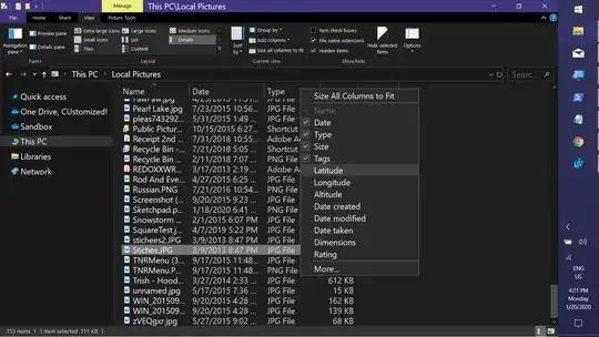
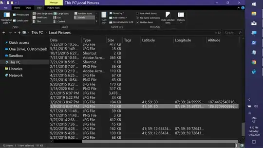
Partial Answer: Adding GPS.(Altitue|Latitude|Longitude) columns to the Pictures FolderType in Explorer

Save the following as a .reg file. Right-click & Merge. Restart Explorer or Sign out & back in.

Windows Registry Editor Version 5.00

[HKEY_CURRENT_USER\Software\Microsoft\Windows\CurrentVersion\Explorer\FolderTypes\{b3690e58-e961-423b-b687-386ebfd83239}\TopViews\{00000000-0000-0000-0000-000000000000}]
"ColumnList"="prop:0System.ItemNameDisplay;0System.ItemDate;0System.ItemTypeText;0System.Size;0System.Keywords;1System.GPS.Latitude;1System.GPS.Longitude;1System.GPS.Altitude;1System.DateCreated;1System.DateModified;1System.Photo.DateTaken;1System.Image.Dimensions;1System.Rating"
"IconSize"=dword:00000060
"LogicalViewMode"=dword:00000003
"Name"="NoName"
"Order"=dword:00000000

Result: GPS Columns Available

GPS Columns Added

Keith Miller
  • 10,694
  • 1
  • 20
  • 35